Tag: geology

  • Why Do Some Beaches Squeak and Others Boom? The Physics of Singing Sand

    Why Do Some Beaches Squeak and Others Boom? The Physics of Singing Sand

    Imagine walking along a beach and hearing a sharp squeak under your feet, like a dog toy being stepped on. Or standing on a desert dune as an avalanche of sand produces a deep, resonant hum that can be heard a hundred meters away. These are not supernatural occurrences—they are real acoustic phenomena known as squeaking and booming sand, and they have puzzled travelers and scientists for centuries.

    The secret lies not in the sand itself, but in the way grains move past each other. When conditions are just right—when grains are similar in size, smooth, and completely dry—sand can emit sounds that range from a high-pitched whistle to a low-frequency boom. This article explains the physics behind these sounds, the geological conditions required, and why only a few beaches and dunes on Earth ‘sing.’

    The Two Sounds: Squeak vs. Boom

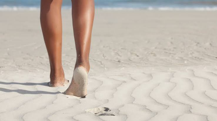
    Squeaking sand produces a high-pitched, sharp sound, often compared to a squeaky shoe on a gym floor or a dog toy. It typically happens when you walk on or compress the sand, and it is common on certain beaches, like Kotohiki Beach in Japan or some shores in Hawaii and the UK. The sound is short-lived and occurs with each step.

    Booming sand, on the other hand, produces a low-frequency hum—like a cello, foghorn, or distant propeller—that can last for several seconds and be heard up to 100 meters away. This phenomenon is rarer and occurs mainly in desert dunes, such as Kelso Dunes in California, Sand Mountain in Nevada, and the Booming Dunes in the Namib Desert. The sound is triggered by avalanches, either natural or caused by humans sliding down the dune.

    Though the two sounds are very different, they share the same underlying mechanism: the synchronized motion of sand grains.

    The Physics: How Sand Grains Make Music

    To understand why sand sings, we need to look at how granular materials behave. Sand is a collection of discrete particles that can act like a solid, liquid, or gas depending on the stress applied. When you step on ordinary sand, the grains collide randomly, and the energy dissipates as heat—no sound. But in ‘singing’ sand, something remarkable happens: the grains begin to collide in phase, creating a coherent vibration that travels to the surface and into the air as sound.

    This synchronization is similar to how a laser produces coherent light from random photon emissions. In normal sand, collisions are random. In singing sand, the grains are so uniform and smooth that when they slide past each other in a thin layer, they fall into a rhythm. This layer, called a shear band, is only about 10 to 100 grains thick. The frequency of the resulting sound is determined by the grain size: larger grains produce lower frequencies (booming), while smaller grains produce higher frequencies (squeaking). This was demonstrated in a 2012 study in Physical Review Letters by Stéphane Douady’s team, which showed that the frequency is inversely proportional to grain diameter.

    So, a beach with fine, uniform sand will squeak, while a dune with larger, rounder grains will boom.

    The Perfect Conditions: Why Not All Sand Sings

    If the mechanism is simple, why is singing sand so rare? It requires a precise combination of factors:

    • Grain size: Booming sand typically has grains 0.2–0.5 mm in diameter; squeaking sand is finer, at 0.1–0.3 mm.
    • Grain shape: Grains must be spherical and smooth. Quartz sand that has been wind-polished over millennia is ideal.
    • Sorting: The sand must be well-sorted—all grains roughly the same size. Glacial or river sand is usually too mixed.
    • Dryness: Even 1–2% moisture can dampen the vibration. This is why singing is more common in deserts or after prolonged dry spells on beaches.

    Moisture creates capillary bridges between grains, which absorb energy and stop the synchronization. Angular or mixed grains scatter energy, also killing the sound.

    Beaches vs. Dunes: Why the Difference?

    Beaches typically produce squeaking sounds because wave action sorts sand into finer, more uniform grains. Dunes, on the other hand, are formed by wind, which selects for larger, rounder grains. That’s why you hear a high-pitched squeak on a beach and a low boom on a dune. However, some beaches have been reported to ‘sing’ like dunes, but this is rare and requires very specific conditions.

    The History and Science

    Singing sand has been known anecdotally for centuries. Charles Darwin and other explorers documented booming dunes in their travelogues in the 19th century. But it wasn’t until the 2000s that scientists began to unravel the mystery. Researchers like Stéphane Douady and Simon Dagois-Bohy used high-speed cameras and acoustic sensors to capture the motion of grains during avalanches. In 2015, Caltech and Cambridge researchers modeled the shear and collision dynamics, confirming that sound arises from synchronized grain collisions.

    One common myth is that the sound comes from air trapped between grains or from piezoelectric effects. Neither is true. The sound is purely mechanical, emerging from the collective motion of grains.

    Why It Matters

    Studying singing sand is not just a curiosity. It helps scientists understand granular physics, a branch of soft-matter physics that applies to many fields, from pharmaceuticals to construction. The principles of synchronization in granular materials could also inspire new acoustic technologies or better understanding of landslides and avalanches.

    So, the next time you walk on a squeaky beach, remember: you’re not just hearing sand—you’re hearing the music of millions of grains moving in perfect harmony.

    Singing sand is a rare and beautiful example of self-organization in nature. It requires the perfect combination of grain size, shape, sorting, and dryness. The next time you visit a beach or desert, pay attention to the sound under your feet—you might just hear the earth’s own symphony.

    Summary

    • Singing sand produces two types of sounds: squeaking (high-pitched) and booming (low-frequency hum).
    • The sound comes from synchronized grain collisions in a thin shear band, not from air or piezoelectric effects.
    • The frequency depends on grain size: larger grains boom, smaller grains squeak.
    • Dryness, uniform grain size, and smooth rounded grains are essential.
    • Beaches usually squeak because wave action creates fine uniform sand; dunes boom because wind selects for larger grains.

    FAQ

    Q: Why does sand squeak when I walk on it?
    A: Squeaking occurs when sand grains are uniform and dry, causing them to collide in sync under your foot. The high pitch is due to the small grain size.

    Q: Is booming sand only found in deserts?
    A: Yes, booming sand is primarily found in desert dunes, where wind creates large, round, well-sorted grains. Beaches usually produce squeaks due to finer sand.

    Q: Can any beach sing?
    A: Only if the sand is very dry, well-sorted, and composed of smooth grains. Most beaches don’t meet these criteria, which is why singing beaches are rare.

    Q: What is the shear band?
    A: It’s a thin layer of sand grains (10-100 grains thick) near the surface where grains slide past each other during an avalanche or footstep, producing the sound.

    Q: How loud can singing sand be?
    A: Booming sand can be heard up to 100 meters away and can last for several seconds. Squeaking sand is usually quieter and shorter-lived.
  • The Vanished Lake of the Atacama: How a Bolivian Salt Flat Explains the World’s Driest Desert

    The Vanished Lake of the Atacama: How a Bolivian Salt Flat Explains the World’s Driest Desert

    In the heart of the Atacama Desert, one of the most arid places on Earth, lies a clue to a time when this landscape was underwater. The Salar de Uyuni in Bolivia, the world’s largest salt flat, is the dried-up remnant of a prehistoric lake that once covered an area larger than modern-day Lake Titicaca. This vanished lake, known as Lake Minchin or Tauca, existed during the late Pleistocene, roughly 45,000 to 15,000 years ago, when the Altiplano experienced a wetter ‘pluvial’ period.

    Today, the Atacama is famous for its extreme dryness, with some weather stations recording zero historical rainfall. But the story of how it became so dry is not just about the present—it’s a tale of ancient water, shifting climates, and a salt flat that holds secrets to both Earth’s past and our future.

    The Atacama’s Aridity: More Than Just a Dry Spell

    The Atacama Desert stretches across northern Chile and into parts of Peru, Bolivia, and Argentina, covering roughly 105,000 square kilometers. It’s the driest non-polar desert on Earth, a title it earns through a combination of factors. The towering Andes Mountains block moisture from the Atlantic, creating a rain shadow. The cold Humboldt Current off the Pacific coast suppresses evaporation and rainfall. And a semi-permanent high-pressure system, the Pacific Anticyclone, keeps the skies clear. These forces have shaped the desert over millions of years, but the vanished lake adds a temporal dimension: the Atacama wasn’t always this dry.

    During the late Pleistocene, the Altiplano—a high plateau shared by Bolivia, Chile, and Peru—hosted a massive lake system. Lake Minchin, and its successor Lake Tauca, expanded and contracted in cycles, covering up to 50,000 square kilometers at their peak. That’s several times larger than today’s Lake Titicaca, the world’s highest navigable lake. The evidence for this ancient water is etched into the landscape: paleo-shorelines terraced into hillsides, sediment layers rich in diatomite (fossilized algae), and the remains of aquatic organisms like stromatolites and ostracods.

    The Salar de Uyuni: A Dried-Up Lake’s Legacy

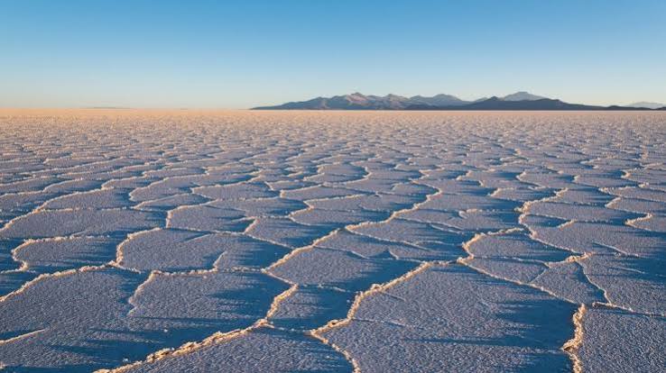
    When the climate aridified around 15,000 to 10,000 years ago, the lake evaporated, leaving behind vast salt flats—the largest being Salar de Uyuni in Bolivia. This flat, at 3,650 meters elevation, is a surreal expanse of white salt crust, stretching over 10,582 square kilometers. During the rainy season, a thin layer of water transforms it into a giant mirror, a phenomenon that attracts tourists from around the world.

    But the salar is more than a tourist attraction. Beneath its surface lies a brine rich in lithium, an estimated 21 million tonnes, making it central to the global battery economy. This lithium is a direct consequence of the ancient lake: as the water evaporated, it left behind concentrated salts, including lithium, which had been leached from the surrounding rocks over millennia. The same process created the lithium-rich brines in Chile’s Salar de Atacama, now a major mining site.

    The salar’s history is also a crucial archive for scientists. Sediment cores drilled from the salt flat reveal wet-dry cycles that correlate with global climate events, such as Heinrich events and Antarctic cold reversals. By studying these layers, paleoclimatologists can model past precipitation patterns and understand the dynamics of the South American Summer Monsoon, which was driven by shifts in the Intertropical Convergence Zone and orbital cycles (Milankovitch forcing).

    From Ancient Lake to Mars Analog

    The Atacama’s hyper-arid core, often called the ‘absolute desert,’ is one of the most Mars-like environments on Earth. NASA uses it as a test site for life-detection instruments, and the vanished lake’s evaporite minerals—gypsum, halite, and others—are similar to those found by Mars rovers. These minerals hint at past water on Mars, and studying how they formed in the Atacama helps scientists interpret Martian geology.

    The link between the vanished lake and modern aridity also informs debates about when the Atacama became hyper-arid. Some evidence suggests aridity onset as early as 15 million years ago, when the Andes reached sufficient height to block Atlantic moisture, but the lake’s existence shows that wetter periods punctuated this trend. Understanding these fluctuations is vital for predicting how the desert might respond to future climate change.

    Cultural and Economic Echoes

    The Atacama and the Altiplano have been home to indigenous peoples for millennia. The Atacameño, or Likan Antai, developed sophisticated water management systems, like raised-field agriculture (camellones), to thrive in this extreme environment. While the vanished lake predates human memory, the salt flats and mineral wealth shaped trade routes, with llama caravans carrying salt and copper across the Andes.

    Today, the lithium boom has brought new attention to the region, sparking geopolitical interest. Bolivia’s Salar de Uyuni and Chile’s Atacama salars are at the center of a global race for battery metals. The ancient lake’s legacy is thus not just a geological curiosity; it’s a resource that could power the world’s transition to electric vehicles.

    A Window into Earth’s Past and Future

    The vanished lake of the Atacama is a reminder that our planet’s most extreme environments are not static. It challenges the assumption that the driest desert was always dry, offering a timeline of climatic shifts driven by astronomical and geological forces. As we face our own climate crisis, this ancient story underscores the dynamic nature of Earth’s systems and the interconnectedness of water, geology, and life.

    The next time you see a salt flat or hear about lithium mining, remember the lake that once stood there—a vast body of water that shaped the land, the minerals, and the cultures that followed. It’s a story written in salt, waiting for us to read.

    The Atacama’s aridity is not a fixed feature but a chapter in a longer geological narrative. The vanished lake that left behind Salar de Uyuni is a key to understanding the desert’s past, its present resources, and its potential future. As scientists study these ancient waters, they not only unlock Earth’s history but also inform our search for life on Mars and our management of critical minerals. The salt flat is more than a barren expanse—it’s a chronicle of change, resilience, and adaptation.

    Summary

    • The Atacama Desert is the driest non-polar desert, but it wasn’t always so; a vast lake once covered parts of the Altiplano.
    • Lake Minchin/Tauca existed ~45,000–15,000 years ago, leaving behind the Salar de Uyuni, the world’s largest salt flat.
    • The lake’s evaporation concentrated lithium, making the salar a key global source of this battery metal.
    • Sediment records from the salt flat reveal past climate cycles, aiding paleoclimate research and Mars analog studies.
    • The vanished lake highlights the dynamic nature of Earth’s climate and the interplay between geology, culture, and economy.

    FAQ

    Q: How did the Atacama become the driest desert?
    A: The Atacama’s aridity results from the Andes rain shadow, the cold Humboldt Current, and the Pacific Anticyclone. These factors block moisture and suppress rainfall, creating hyper-arid conditions.

    Q: What was Lake Minchin?
    A: Lake Minchin was a massive prehistoric lake that covered parts of the Altiplano during the late Pleistocene. It was part of a system of lakes that expanded and contracted with climate cycles.

    Q: Why is Salar de Uyuni important?
    A: Salar de Uyuni is the world’s largest salt flat and a remnant of the vanished lake. It contains significant lithium reserves, crucial for batteries, and serves as a site for scientific research and tourism.

    Q: How does the vanished lake relate to Mars?
    A: The Atacama’s hyper-arid environment and evaporite minerals mimic Martian conditions, making it a testing ground for Mars missions. The lake’s history helps scientists understand past water on Mars.

    Q: Did indigenous people interact with the lake?
    A: The lake existed long before humans, but indigenous peoples like the Atacameño adapted to the desert’s salinity and developed water management techniques. The salt flats influenced trade and settlement patterns.

  • What Lake Bonneville Left Behind: A Prehistoric Giant’s Legacy in the Great Basin

    What Lake Bonneville Left Behind: A Prehistoric Giant’s Legacy in the Great Basin

    Imagine a lake so vast it could swallow modern-day Lake Michigan, with waves crashing against mountain slopes in what is now the arid desert of Utah. That was Lake Bonneville, a prehistoric colossus that existed during the last ice age, roughly 32,000 to 14,000 years ago. Its footprint spans parts of Utah, Nevada, and Idaho, and its legacy is etched into the landscape in ways you can still see today if you know where to look.

    When Lake Bonneville vanished, it didn’t just disappear. It left behind a suite of remnants—from the salty expanse of the Great Salt Lake to the razor-flat Bonneville Salt Flats—and a geological story that scientists still study to understand climate change, catastrophic floods, and even the Earth’s crust. This article explores what the lake left behind, why those leftovers matter, and how they’ve shaped everything from land-speed records to human settlement.

    The Lake That Ruled the Great Basin

    Lake Bonneville was a pluvial lake, formed during the Pleistocene when the climate was cooler and wetter. At its peak, around 18,000 to 16,500 years ago, it covered roughly 20,000 square miles—about the size of Lake Michigan. Its deepest point plunged to around 1,000 feet, making it a formidable inland sea.

    The lake wasn’t just a static body of water. It had a dynamic history, with cycles of rise and fall recorded in its sediments. Geologists identify these as the Bonneville, Provo, and Gilbert cycles, each leaving distinct layers of mud and minerals that read like a diary of ancient climate.

    The Great Breach: A Flood That Reshaped the Land

    Around 14,500 years ago, Lake Bonneville reached its tipping point. It overtopped its natural rim at Red Rock Pass in southeastern Idaho, and the resulting breach unleashed a catastrophic flood. Known as the Bonneville Flood, it drained a significant portion of the lake in weeks or months, carving the Snake River Plain and leaving scabland features downstream.

    This wasn’t just a local event. The flood’s power is a case study in catastrophic geomorphology, and it helped scientists understand how sudden water releases can reshape entire landscapes. After the breach, the lake stabilized at a lower level, known as the Provo shoreline, before slowly receding as the climate warmed.

    The Remnants: From Great Salt Lake to Salt Flats

    The lake’s disappearance left a chain of remnants, each with its own character:

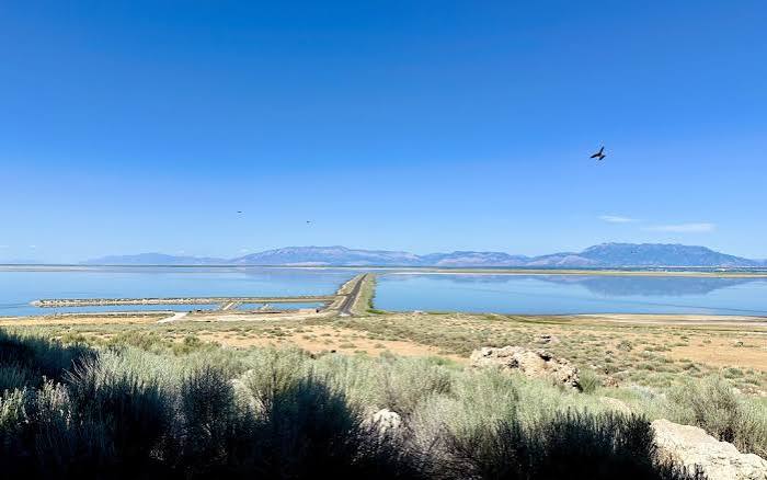
    • Great Salt Lake: The largest survivor, now a shallow, hypersaline body of water—so salty that only brine shrimp and algae can thrive.
    • Utah Lake: A freshwater remnant in Utah Valley, vital for local ecosystems and agriculture.
    • Sevier Lake: Mostly dry now, a playa that occasionally fills with water.
    • Bonneville Salt Flats: A vast, flat crust of salt covering about 30,000 acres in northwestern Utah.
    • Great Salt Lake Desert: The broader playa region surrounding the salt flats.

    Each remnant tells a piece of the lake’s story. The salt flats, for instance, are the result of the final waters evaporating, leaving behind concentrated salts—sodium chloride, potassium, magnesium, and sulfates.

    Ancient Shorelines: Benches in the Mountains

    One of the most striking remnants is not water at all—it’s the ancient shorelines. As you look at the Wasatch Range or the Oquirrh Mountains, you can see horizontal benches etched into the slopes. These are wave-cut terraces and gravel bars from when the lake lapped against the mountains.

    The highest, called the Bonneville shoreline, marks the lake’s maximum extent. A secondary one, the Provo shoreline, reflects the post-breach stabilization. These shoreline features are among the clearest evidence of past climate change in the Quaternary period.

    Beyond shorelines, the lake left spits, bars, and tombolos—like Stockton Bar and the Stansbury Island tombolo. There are also tufa deposits, calcium carbonate formations created by algae and spring activity along the old shorelines. Gilbert Peak, in the Oquirrhs, was once an island in the ancient lake.

    The Bonneville Salt Flats: A Playground for Speed

    The Bonneville Salt Flats are more than just a geological curiosity—they’re a world-famous racing venue. Since 1914, the flats have hosted land-speed records, thanks to their flat, hard, perfectly level surface. The crust is so smooth that it’s ideal for high-speed runs.

    Notable records include Malcolm Campbell’s 301 mph run in 1935, Craig Breedlove’s 400+ mph in 1963, and Andy Green’s supersonic 763 mph in 1997 in the ThrustSSC. The Bonneville Speedway, managed by the Bureau of Land Management, is a designated racing area.

    But the flats also have an industrial side. They’ve been commercially mined for salt and minerals since the early 20th century, which has raised questions about how extraction affects the surface’s stability and racing quality.

    Human History Along the Ancient Shores

    The lake’s remnants have shaped human history, too. Paleo-Indians, including Clovis cultures, hunted megafauna along the receding shores. Later, Fremont and Shoshone peoples used the wetlands and marshes that formed around the remnant lakes.

    In the 1840s, the Great Salt Lake Desert became a notorious obstacle for emigrants. The Donner Party crossed it in 1846 with disastrous results, and other wagon trains suffered in the treacherous salt crust. When Mormon pioneers arrived in 1847, they settled in the Salt Lake Valley, using the remnants for water, agriculture, and salt extraction.

    In 1869, the Transcontinental Railroad was completed at Promontory Summit, crossing the northern edge of the old lakebed—a route that would have been underwater just millennia before.

    Scientific Significance: A Natural Laboratory

    Lake Bonneville is a type locality for pluvial lake studies worldwide. Its shorelines and sediments provide a detailed record of climate change, and its history helps calibrate glacial-isostatic adjustment models. The weight of the lake depressed the Earth’s crust, and as the water disappeared, the crust has been rebounding—a slow, ongoing process that scientists can measure.

    The Bonneville Flood is a key case study in catastrophic flood geomorphology, helping researchers understand how sudden water releases shape landscapes. And the lake’s sediments are a treasure trove for geologists, with each layer holding clues about ancient climates and ecosystems.

    The Legacy Lives On

    Lake Bonneville may be gone, but its legacy is all around us. From the shores of the Great Salt Lake to the speed records on the salt flats, from the benches on the mountains to the sediment cores in labs, the lake’s influence persists. It’s a reminder that landscapes are not static—they’re shaped by forces we can still see in action today.

    Lake Bonneville’s story is one of dramatic transformation—a lake that once rivaled the Great Lakes, that carved canyons with a catastrophic flood, and that left behind a landscape of salt, water, and stone. Its remnants continue to shape the environment, the economy, and even human adventure. The next time you see the Great Salt Lake or drive across the Bonneville Salt Flats, you’re looking at the ghost of a giant—and a living laboratory for understanding our changing planet.

    Summary

    • Lake Bonneville was a massive pluvial lake during the last ice age, covering ~20,000 sq miles at its peak.
    • A catastrophic breach around 14,500 years ago caused the Bonneville Flood, carving the Snake River Plain.
    • Remnants include Great Salt Lake, Utah Lake, Sevier Lake, and the Bonneville Salt Flats.
    • Ancient shorelines, spits, and tufa deposits are visible in the surrounding mountains.
    • The Bonneville Salt Flats are a premier land-speed racing venue and a site of salt mining.
    • Lake Bonneville is crucial for studying climate change, crustal rebound, and catastrophic floods.

    FAQ

    Q: How big was Lake Bonneville compared to today’s lakes?nA: At its maximum, Lake Bonneville covered about 20,000 square miles, roughly the size of Lake Michigan. It was about 1,000 feet deep at its deepest point.nnQ: What caused the Bonneville Flood?nA: The lake overtopped its natural rim at Red Rock Pass in Idaho, causing a breach that released a catastrophic flood, draining a significant portion of the lake in weeks or months.nnQ: Where can I see evidence of Lake Bonneville today?nA: Look for horizontal benches on mountains like the Wasatch Range—these are ancient shorelines. You can also visit the Great Salt Lake, Utah Lake, or the Bonneville Salt Flats.nnQ: Why is the Bonneville Salt Flats so flat and hard?nA: The salt flats formed as the lake’s final waters evaporated, leaving a thick crust of salts that is naturally level and hard, making it ideal for racing.nnQ: How did Lake Bonneville affect human history?nA: The lake’s remnants provided water, salt, and wetlands that attracted early peoples, and later challenged pioneers like the Donner Party. The railroad also crossed the old lakebed.

  • Norwegian Fjords vs. New Zealand Fjords: Which Is More Dramatic?

    Norway vs. New Zealand: A Tale of Two Natural Wonders

    Imagine standing at the edge of a cliff, looking down a sheer rock face that plunges a thousand meters into dark, silent water. Farther north, you might see snow-capped peaks reflected in a turquoise-blue channel, while in the south, the water is so black it looks like oil, and rain waterfalls streak down every crevice. These are the fjords of Norway and New Zealand—two of the most spectacular glacial landscapes on Earth. But which one is truly more dramatic? The answer depends on what you mean by ‘dramatic’.

    Both regions were carved by the same force: massive glaciers that ground their way through ancient rock over millions of years. Yet the resulting scenery could hardly be more different. Norway offers immense scale and alpine grandeur, with over 1,000 fjords stretching deep into a mountainous interior. New Zealand’s Fiordland counters with raw, wet, rainforest-clad cliffs and a sense of wild isolation that few places can match. In this explainer, we’ll break down the defining features of each—geology, scale, water, and even weather—to help you decide which fjord experience calls to you.

    The Making of a Fjord: Same Sculptor, Different Canvas

    A fjord is formed when a glacier carves a U-shaped valley that extends below sea level, and then the sea floods in after the ice retreats. Norway and New Zealand both owe their fjords to the great ice ages of the past few million years. But the raw materials differed.

    Norway’s fjords cut through some of the oldest rocks on Earth—Precambrian and Caledonian formations up to 2.5 billion years old. These rocks are hard and resistant, but the glaciers were relentless, carving channels that reach depths of over 1,300 meters (4,291 feet) in Sognefjord. The result is a landscape of extreme verticality: cliffs often rise 1,000–1,400 meters straight from the water, and the overall scale is staggering. Norway has more than 1,000 named fjords, the longest being Sognefjord at 204 kilometers (127 miles).

    New Zealand’s Fiordland, on the other hand, is a compact but intense cluster of 14 major fjords on the southwestern tip of the South Island. The bedrock here is younger—granites and gneisses around 300–500 million years old—and the region sits on an active plate boundary. The mountains are still rising at a rate of 5–10 millimeters per year, which means the land is being actively uplifted even as the sea carves into it. This tectonic activity gives Fiordland a raw, jagged feel, but the fjords themselves are shorter and shallower: the longest, Doubtful Sound, stretches only 40 kilometers (25 miles), and its deepest point is 421 meters (1,381 feet).

    Scale and Verticality: Norway’s Overwhelming Grandeur

    If you want sheer volume, Norway wins. Sognefjord is not just the longest fjord in the country—it’s one of the longest in the world, and its depth is almost incomprehensible: 1,308 meters from the surface to the seafloor, deeper than many ocean trenches. The cliffs that flank Geirangerfjord rise to 1,700 meters (5,577 feet) above the water, and the UNESCO-listed Nærøyfjord is a narrow, dramatic corridor where the walls seem to close in on you.

    In New Zealand, the scale is smaller, but don’t mistake that for less impact. Milford Sound’s cliffs reach about 1,200 meters (3,937 feet) straight up, and the fjord is a mere 16 kilometers long. It’s a more intimate, enclosed experience, like being in a stone canyon filled with water. Doubtful Sound is wider and more open, but its very remoteness adds to its drama—you have to take a boat across Lake Manapouri and a bus over a pass to get there.

    Water and Weather: Two Different Personalities

    The water itself tells you which fjord you’re in. Norway’s fjords often show a deep blue-green, and in some areas, glacial silt—fine rock flour—gives the water a milky turquoise tint. This is the classic postcard image: clear, cold, and invitingly bright.

    New Zealand’s fjords are nearly the opposite. The dark, tannin-stained water comes from the native beech forests that blanket the steep slopes. Rain leaches organic compounds into the fjords, turning them a deep brown or black that looks almost like ink. Yet there’s a hidden marvel: in Milford Sound, a layer of fresh water from the heavy rainfall sits on top of the salt water, creating a ‘halocline’ that allows deep-sea creatures like black coral to grow at unusually shallow depths—you can see them from a boat, which is extremely rare anywhere else.

    And the rain is another key difference. Milford Sound receives about 6,700 millimeters (264 inches) of rain per year, making it one of the wettest inhabited places on Earth. This downpour is what creates the hundreds of temporary waterfalls that cascade down the cliffs, turning the fjord into a vertical river. Norway is wet, too, with coastal areas getting up to 3,000 millimeters, but it’s a drier, more alpine atmosphere—more snow than rain above the treeline.

    Human and Cultural Layers: Settled vs. Wild

    Norway’s fjords have been central to human life for thousands of years. Fishing villages dot the shores, stave churches perch on the slopes, and the Hurtigruten coastal steamer has plied these waters since the 1800s. The very word ‘fjord’ is Norwegian, and the landscape is woven into the nation’s identity. Tourism here is mature and highly organized: the ‘Norway in a Nutshell’ tour is a classic day trip, and Geirangerfjord alone welcomes over 300,000 cruise passengers each year.

    New Zealand’s Fiordland is a different story. Māori used the area for seasonal hunting and gathering, especially of pounamu (greenstone), but they didn’t settle permanently. Captain Cook arrived in the 1770s and famously doubted whether Doubtful Sound could be navigated. Even today, the region feels wild and untamed. Milford Sound is accessible by road and gets up to a million visitors a year, but Doubtful Sound sees only about 40,000—a fraction of the crowds, and the only way in is a two-part journey across a lake and a mountain pass. The difference is palpable: in Norway, you’re often sharing the fjord with cruise ships; in Fiordland, you can feel like you have the place to yourself.

    The Verdict: Depends on Your Definition of Drama

    So which is more dramatic? It’s a tie, but in different ways. Norway offers the drama of superlatives: longer, deeper, taller, and more numerous. The scale is so vast that it can feel overwhelming, almost impersonal. The cliffs are sheer, the water is deep blue, and the mountains are snow-capped even in summer. It’s the drama of pure size and grandeur.

    New Zealand’s drama is more about mood and motion. The rainforest-clad cliffs, the near-constant rain, the dark water, and the temporary waterfalls give it a sense of raw, living power. The fact that the mountains are still rising means the landscape is literally being shaped as you watch. It’s the drama of wildness and unpredictability.

    If you want to feel small against an enormous backdrop, head to Norway. If you want to feel like you’re in a prehistoric, untamed world, go to Fiordland. Both are masterpieces of glacial artistry—just with different palettes and scales.

    In the end, the question of which fjords are more dramatic is a matter of taste. Norway’s fjords are the grand cathedrals of nature—vast, towering, and awe-inspiring in their sheer dimensions. New Zealand’s fjords are the wild forests of the sea—wet, dark, and alive with the sense of ongoing creation. Whether you prefer the epic scale of Sognefjord or the intimate intensity of Milford Sound, both destinations deliver a spectacle that stays with you long after you leave. The real drama is in the journey—and in the way each fjord makes you feel.

    Summary

    • Norway has over 1,000 fjords, with the longest (Sognefjord) stretching 204 km and the deepest (also Sognefjord) plunging 1,308 m.
    • New Zealand has 14 major fjords in Fiordland, with Doubtful Sound the longest at 40 km and the deepest at 421 m.
    • Cliffs in Norway can rise 1,700 m above the water; in New Zealand, Milford Sound’s cliffs reach about 1,200 m.
    • Water color differs: Norway’s is often blue-green with glacial silt, while Fiordland’s is dark, tannin-stained, and can hide black coral at shallow depths.
    • Rainfall sets them apart: Milford Sound gets ~6,700 mm/year, creating temporary waterfalls, while Norway’s wettest areas get ~3,000 mm.
    • Norway’s fjords are deeply settled and tourist-friendly, with a mature infrastructure; New Zealand’s Fiordland is wilder, with remote Doubtful Sound seeing only ~40,000 visitors a year.

    FAQ

    Q: Which fjords are longer, Norway’s or New Zealand’s?
    A: Norway’s fjords are significantly longer. The longest is Sognefjord at 204 km, while New Zealand’s longest, Doubtful Sound, is only 40 km.

    Q: Are the fjords in New Zealand actually called sounds?
    A: Yes, locals often call them ‘sounds’, but that’s a misnomer—they are true fjords, carved by glaciers, not river valleys drowned by the sea.

    Q: Why is Milford Sound’s water so dark?
    A: The water is stained dark brown or black by tannins from the surrounding native beech forest. Rain leaches organic compounds into the fjord.

    Q: Can you see black coral in Milford Sound?
    A: Yes, unusually shallow depths. The freshwater layer from heavy rain creates a halocline that allows deep-sea organisms like black coral to thrive at depths of just a few meters.

    Q: Which is easier to visit, Norwegian fjords or Fiordland?
    A: Norway has more extensive infrastructure, with roads, tunnels, ferries, and the famous Flåm Railway. Fiordland’s Milford Sound is also accessible by road, but Doubtful Sound requires a boat transfer across Lake Manapouri and a bus over a pass.

  • Unraveling the Mystery of Antarctica’s Blood Falls: Ancient Seawater Revealed

    Unraveling the Mystery of Antarctica’s Blood Falls: Ancient Seawater Revealed

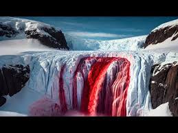
    For over a century, the blood-red waterfall cascading from Taylor Glacier in Antarctica has puzzled scientists and captured imaginations. Known as Blood Falls, this five-story-tall crimson feature stains the ice with a striking hue, but its origin remained a mystery. Now, a new study offers a compelling answer: the brine feeding Blood Falls may be ancient seawater trapped millions of years ago when sea levels were higher. This discovery not only solves a long-standing geological puzzle but also provides a unique window into Earth’s climatic past and the potential for life in extreme environments.

    A Century-Old Enigma

    Blood Falls was discovered in 1911 by Griffith Taylor, a geologist on Robert Falcon Scott’s Terra Nova Expedition. Taylor, who also named the Dry Valleys, was the first to document the eerie red waterfall. For decades, scientists debated its source, with theories ranging from iron-oxidizing bacteria to algae or simply iron minerals from bedrock. It wasn’t until the late 20th century that researchers confirmed the red color comes from iron-rich brine that oxidizes (rusts) upon contact with air. But the ultimate origin of the brine remained elusive.

    The New Study: A Marine Origin

    The new study, published in a peer-reviewed journal, suggests that the brine feeding Blood Falls originated from seawater trapped in a basin or fjord millions of years ago. During the Miocene epoch (about 14–20 million years ago), sea levels were significantly higher—up to 30–60 meters above present levels. At that time, marine embayments may have extended into the McMurdo Dry Valleys, where Taylor Glacier now flows.

    As sea levels dropped, the trapped seawater became isolated. Through a process called cryoconcentration, freezing concentrated the salts, leaving behind a hypersaline brine that remains liquid even at subzero temperatures due to its high salinity. This brine now discharges slowly through fractures in the glacier, emerging at the surface as Blood Falls.

    Geochemical Fingerprints

    The study likely used isotopic signatures—such as oxygen-18, deuterium, and strontium—to fingerprint the brine’s source. These geochemical tracers can distinguish between marine water, meteoric water (from precipitation), and ancient lake water. The results point to a marine origin, ruling out subglacial meltwater as the primary source. This is a significant finding because it ties the brine to a specific paleoclimatic period, offering insights into past Antarctic ice sheet dynamics and sea-level sensitivity.

    Implications for Life and Astrobiology

    Blood Falls is not just a geological curiosity; it’s a hotspot for microbial life. A landmark 2015 study by Lanoil et al. found a viable microbial ecosystem in the brine, with bacteria surviving without sunlight or oxygen, using sulfate and iron as electron acceptors. If the brine is indeed ancient seawater, these microbes may be descendants of marine organisms trapped for millions of years—a ‘time capsule’ ecosystem.

    This makes Blood Falls a key analog for life on icy moons like Europa and Enceladus, which harbor subsurface oceans. Understanding the origin of the brine helps astrobiologists interpret potential biosignatures in such environments. If life can persist in a subglacial brine for millions of years, it bodes well for the possibility of life in similar extraterrestrial settings.

    Addressing Misconceptions

    Despite its name, Blood Falls is not a waterfall of blood. The red color is purely chemical—iron oxidation—not biological. The brine is also very cold, around −5°C to −10°C, and remains liquid due to its salinity, not geothermal heat. The discharge is intermittent and slow, often described as a ‘trickle’ or ‘seep’ rather than a vigorous waterfall. And importantly, the new study suggests the brine was emplaced in the subglacial basin beneath the glacier, not that seawater is frozen inside the glacier itself. The glacier later overrode the basin, and the brine now seeps out through fractures.

    A Window into the Past

    The origin of Blood Falls’ brine has broader implications for understanding Antarctica’s climatic history. The Miocene was a period of warmer conditions and higher sea levels, and the presence of marine brine in the Dry Valleys suggests that the East Antarctic Ice Sheet was more dynamic than previously thought. This has implications for predicting future sea-level rise in a warming world.

    While the new study provides strong evidence for a marine origin, some researchers may argue that the brine could still be derived from subglacial meltwater that interacted with marine sediments. The distinction matters for interpreting the age and isolation of the brine. Nevertheless, the study marks a significant step forward in solving a century-old mystery.

    The discovery that Blood Falls’ brine may be ancient seawater trapped millions of years ago not only solves a geological puzzle but also enriches our understanding of life’s resilience and Earth’s climatic history. As research continues, Blood Falls remains a captivating reminder of the hidden wonders beneath Antarctica’s ice.

    Summary

    • Blood Falls is a blood-red waterfall in Antarctica, colored by iron-rich brine that oxidizes on contact with air.
    • A new study suggests the brine originated from seawater trapped in a basin or fjord millions of years ago when sea levels were higher.
    • The brine was concentrated by freezing (cryoconcentration) and remains liquid due to its high salinity.
    • Geochemical tracers point to a marine origin, ruling out subglacial meltwater as the primary source.
    • The brine hosts a viable microbial ecosystem, making Blood Falls a key analog for life on icy moons.

    FAQ

    Q: What is Blood Falls?
    A: Blood Falls is a five-story-tall, blood-red waterfall flowing from Taylor Glacier in Antarctica. The red color comes from iron-rich brine that oxidizes (rusts) upon contact with air.

    Q: How did the brine form?
    A: The brine likely originated from seawater trapped in a basin or fjord millions of years ago when sea levels were higher. As sea levels dropped, the seawater became isolated and concentrated by freezing, leaving a hypersaline brine that remains liquid at subzero temperatures.

    Q: Is the water hot?
    A: No, the brine is very cold, around −5°C to −10°C. It remains liquid due to its high salinity, not geothermal heat.

    Q: Does Blood Falls flow continuously?
    A: No, the discharge is intermittent and slow, often described as a ‘trickle’ or ‘seep’ rather than a vigorous waterfall.

    Q: Why is Blood Falls important for astrobiology?
    A: The brine hosts a viable microbial ecosystem that survives without sunlight or oxygen, making it a terrestrial analog for subsurface oceans on icy moons like Europa and Enceladus. Understanding its origin helps scientists interpret potential biosignatures in such environments.