Tag: Pacific

  • How Polynesian Wayfinders Navigated the Pacific Without Instruments


    Imagine sailing across 2,600 miles of open ocean in a double-hulled canoe, with no GPS, compass, or sextant. Your only guides are the stars, the swells, and the flight patterns of seabirds. This was the reality for Polynesian wayfinders, who settled the vast Pacific triangle—an area twice the size of the contiguous United States—between 1,500 and 1,000 years ago. Their voyages, spanning distances like Hawaiʻi to Tahiti (about 2,600 miles), were deliberate and round-trip, as proven by the revival voyages of the Hōkūleʻa in the 1970s.

    For centuries, Western scholars debated whether Polynesians could have intentionally sailed against prevailing winds. Some argued for accidental drift, others for an American origin. But the revival of traditional wayfinding—sparked by master navigator Mau Piailug from Micronesia—demonstrated that these voyages were not only intentional but masterfully guided by a sophisticated understanding of nature. This article unpacks the tools of the Polynesian navigator, the science behind the art, and why this knowledge was almost lost—and how it was brought back.

    The Star Compass: A Mental Map of the Sky

    Unlike a physical compass with a magnetic needle, the Polynesian star compass is a conceptual framework built around the rising and setting points of stars and constellations. Navigators divided the horizon into 32 or more “houses,” each associated with a specific star or star group. For example, Hōkūleʻa (Arcturus) rises in the northeast, and ʻIwa (the Southern Cross) marks the south. By memorizing the sequence of stars as they rise and set, a navigator can determine direction at any time of night.

    The star compass also aided daytime navigation. The sun’s position and the pattern of shadows on the canoe’s hull provided directional cues. At dawn and dusk, the navigator would note where key stars appeared on the horizon, then hold that course through the day by watching the sun’s arc and the feel of the wind and waves.

    Reading the Ocean: Swells, Clouds, and Bioluminescence

    Even when land is beyond the horizon, it leaves traces on the ocean and sky. Navigators read the direction of ocean swells—long, rolling waves generated by distant winds. When these swells encounter an island, they bend or refract, creating patterns that can be felt in the canoe’s motion. A skilled wayfinder can sense these disruptions and infer the presence of land, even if it’s 50 miles away.

    Cloud formations also betray islands. Flat-bottomed cumulus clouds often form over warm landmasses, and a “lagoon glow”—a faint luminescence reflecting off shallow water—can be visible at night. During the day, navigators watch for seabirds: flocks that fly out to sea at dawn and return at dusk are heading to and from their island roosts. Each species has a known foraging range, so the direction and behavior of birds give clues to proximity and bearing.

    The Science Behind the Art

    Modern research confirms the physical basis of these cues. Oceanographers have measured how swells refract around islands, and meteorologists explain the formation of cumulus clouds over heated land. The navigator’s practice is an applied science, synthesizing astronomy, oceanography, meteorology, and biology. But it also relies on dead reckoning—estimating position from speed, time, and direction—while constantly updating a mental map of the voyage.

    The precision required is staggering. To reach a small atoll from thousands of miles away, a navigator must hold a course within a few degrees, compensating for currents and leeway (the sideways drift of the canoe). This demands intense focus and a deep familiarity with the sea.

    The Loss and Revival of the Knowledge

    After European contact, inter-island voyaging declined due to disease, colonial disruption, and the introduction of Western navigation tools. By the 20th century, only a handful of elders in Micronesia retained the full traditional knowledge. In Hawaiʻi and most of Polynesia, the art was effectively extinct.

    The revival began in the 1970s with the Polynesian Voyaging Society (PVS), founded in Honolulu in 1973. They built Hōkūleʻa, a replica double-hulled canoe, and in 1976 completed a successful voyage to Tahiti. The navigator was Mau Piailug, a master from Satawal in Micronesia, who generously shared his knowledge. This sparked a cultural renaissance, and Nainoa Thompson became the first Hawaiian in about 600 years to navigate long distances without instruments, trained under Piailug.

    Hōkūleʻa’s voyages proved that Polynesian navigation was deliberate and accurate, overturning the “accidental drift” theory. They also became a powerful symbol of Indigenous resilience and identity, part of the broader Hawaiian Renaissance that reclaimed language, hula, and cultural pride.

    The Wayfinder’s Toolkit Today

    Today, PVS continues to train new navigators and sail educational voyages, including a worldwide voyage from 2014 to 2017. The knowledge is no longer lost, but it remains a demanding discipline. As Nainoa Thompson says, “The ocean is a place of extremes, but it also teaches you humility.” Wayfinding is not just a historical curiosity; it is a living practice that connects modern Polynesians to their ancestors and offers a profound lesson in human ingenuity.

    Polynesian wayfinding stands as one of the greatest achievements in human navigation. Without any instruments, these voyagers crossed the Pacific using the stars, swells, and seabirds as their guide. The revival of this art, led by figures like Mau Piailug and Nainoa Thompson, not only proved the intentionality of Polynesian settlement but also restored a vital cultural heritage. As we look to a future of GPS and satellite navigation, the wayfinder’s skill reminds us that knowledge of the natural world can be just as precise—and far more profound.

    Summary

    • Polynesian wayfinders colonized the Pacific triangle, an area twice the size of the contiguous United States, between 1,500 and 1,000 years ago.
    • They used a star compass, swell patterns, cloud formations, seabird behavior, and marine life cues—no instruments.
    • The knowledge was lost after European contact but revived in the 1970s by the Polynesian Voyaging Society and master navigator Mau Piailug.
    • Hōkūleʻa’s successful voyages proved that Polynesian settlement was intentional, not accidental.
    • Modern research validates the scientific basis of wayfinding cues, and the practice continues today as a symbol of cultural resilience.

    FAQ

    Q: How did Polynesian navigators find their way without maps or instruments?
    A: They used a combination of natural cues: a mental star compass, the sun’s position, ocean swell patterns, cloud formations over islands, seabird flight paths, and even bioluminescence. They also used dead reckoning to estimate their position based on speed, time, and direction.

    Q: Is the star compass a physical device?
    A: No, it’s a conceptual framework. Navigators memorize the rising and setting points of specific stars around the horizon, dividing it into 32 or more segments. This allows them to determine direction at night.

    Q: Why was the knowledge of wayfinding lost?
    A: After European contact, voyaging declined due to disease, colonial disruption, and the introduction of Western navigation tools. By the 20th century, only a few elders in Micronesia retained the full knowledge.

    Q: Who was Mau Piailug?
    A: Mau Piailug was a master navigator from Satawal in Micronesia who shared his traditional knowledge with the Polynesian Voyaging Society in the 1970s. He navigated the Hōkūleʻa on its first successful voyage to Tahiti in 1976.

    Q: What is the significance of the Hōkūleʻa voyages?
    A: They proved that Polynesian settlement was intentional and not accidental, and they sparked a cultural revival, demonstrating that traditional wayfinding is a viable and precise art.
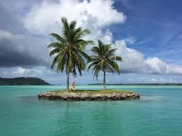
  • 10 Remote Island Nations and the Unique Cultures That Define Them

    10 Remote Island Nations and the Unique Cultures That Define Them

    Imagine a place where the nearest continent is a thousand miles away, where the ocean is your neighbor, and where traditions have evolved in splendid isolation. Remote island nations are not just dots on a map—they are living laboratories of culture, shaped by geography, history, and the sea. From the firewalkers of Fiji to the land divers of Vanuatu, these ten nations offer a glimpse into ways of life that are as fragile as they are fascinating.

    But why should we care about these far-flung places? Because they hold lessons in resilience, community, and adaptation that resonate far beyond their shores. As climate change threatens their very existence, understanding their unique cultures becomes not just an act of curiosity, but a matter of global significance. Let’s embark on a journey to the world’s most remote island nations and discover what makes each one extraordinary.

    What Makes an Island Nation ‘Remote’?

    A remote island nation is a sovereign state made up entirely of islands, far from major continental landmasses. This isolation isn’t just about distance—it’s about the profound impact that separation has on culture, economy, and daily life. For these nations, the ocean is both a barrier and a highway, shaping everything from trade to tradition.

    The Pacific: A Sea of Cultures

    The South Pacific is home to many of the world’s most remote island nations, each with a distinct identity rooted in Austronesian heritage.

    Fiji: Firewalkers and Kava

    Fiji consists of over 330 islands, with about 110 inhabited. Its culture is a dual tapestry: indigenous Fijian traditions and Indo-Fijian influences from indentured laborers brought in the 19th century. One of the most spectacular traditions is firewalking on Beqa Island, where performers walk barefoot over hot stones, a ritual steeped in legend. Kava, a ceremonial drink made from the root of a pepper plant, is central to social gatherings, fostering community and respect.

    Vanuatu: The Birthplace of Bungee Jumping

    Vanuatu’s 80-plus islands are volcanic and rugged. On Pentecost Island, men perform the naghol or land diving, leaping from wooden towers with vines tied to their ankles—a precursor to modern bungee jumping. This ritual, meant to ensure a good yam harvest, is both a test of courage and a spiritual act. With over 100 indigenous languages, Vanuatu is one of the most linguistically diverse places on Earth.

    Samoa: The Samoan Way

    Samoa’s culture is encapsulated in Faʻa Samoa—the Samoan way. It emphasizes the extended family (ʻaiga), the authority of chiefs (matai), and the importance of community. The traditional tattoo (tatau) is a rite of passage, marking one’s commitment to Samoan values. In 2011, Samoa made headlines by skipping December 30th entirely, shifting its dateline to align with trading partners—a bold move that reflects its pragmatic approach to globalization.

    Tonga: The Last Pacific Kingdom

    Tonga is the only Pacific nation never to be colonized, and it remains a monarchy—one of the world’s last. The lakalaka, a traditional dance, is a UNESCO-recognized masterpiece, performed at important events. The concept of anga faka-Tonga (the Tongan way) emphasizes respect, humility, and loyalty to the crown. Tonga’s royal heritage is a source of immense pride and continuity.

    Kiribati: The Nation That Spans Four Hemispheres

    Kiribati is a vast nation of 33 atolls and reef islands, straddling the equator and the International Date Line. It is the only country to lie in all four hemispheres. Its culture is rooted in the maneaba (meeting house), where community decisions are made. The phrase Te Mauri, Te Raoi, ao Te Tabomua (peace, health, prosperity) reflects the nation’s values. Kiribati was the first to welcome the year 2000, a symbolic moment for a nation on the front lines of climate change.

    Marshall Islands: Stick Charts and Nuclear Legacies

    The Marshall Islands are famous for stick charts—intricate navigational tools made of palm ribs and shells that map ocean swells and currents. These were the GPS of the ancient Pacific navigators. Land inheritance is matrilineal, with lineage traced through mothers. However, the islands also bear the scars of US nuclear testing from 1946 to 1958, a legacy that still affects health and environment.

    Palau: Conservation Pioneers

    Palau, a western Pacific nation, is a leader in marine conservation. In 2009, it established the world’s first shark sanctuary, and in 2017, it introduced the Palau Pledge—visitors must sign a stamp in their passport promising to act in an environmentally responsible way. The bai (men’s meeting house) is adorned with storyboard carvings that convey traditional knowledge and laws. Palau’s culture is deeply intertwined with the ocean, and its people are its fiercest guardians.

    The Indian Ocean: Crossroads of Cultures

    Seychelles: A Creole Mosaic

    Seychelles, an archipelago of 115 islands, is a melting pot of African, French, and Asian influences. The Creole language Seselwa is spoken by all, and music like moutya and sega reflects a blend of rhythms. The islands are unique for having both granitic and coral formations, creating a diverse landscape. Seychelles’ high-end tourism economy contrasts with its vibrant local culture, which remains rooted in community and tradition.

    Maldives: Low-Lying and Resilient

    The Maldives, with an average elevation of just 1.5 meters above sea level, is the lowest-lying country on Earth. It is also 100% Sunni Muslim, and its culture is a blend of South Asian, Arab, and African influences. Traditional bodu beru drumming is a lively art form, and family structures are matrilineal, with property often passed through the female line. The Maldives is a stark example of a nation facing existential threat from rising seas, yet its people maintain a vibrant culture.

    The Atlantic: Cape Verde’s Creole Identity

    Cape Verde, off the coast of West Africa, is a volcanic archipelago of 10 islands. Its culture is a rich Creole blend of Portuguese and West African heritage. The music of morna and coladeira, popularized by the legendary Cesária Évora, is melancholic yet soulful, reflecting the islands’ history of emigration and longing. In fact, more Cape Verdeans live abroad than at home, creating a strong diaspora that keeps the culture alive globally.

    Shared Challenges, Unique Responses

    These remote island nations face common challenges: geographic isolation, economic vulnerability, and the existential threat of climate change. Yet each responds in its own way. Kiribati has purchased land in Fiji as a climate refuge, while the Marshall Islands and Palau have Compacts of Free Association with the US, providing economic support. The Maldives and Seychelles have turned to high-end tourism, while Cape Verde leverages its diaspora. Their resilience is a testament to human adaptability.

    Why Their Cultures Matter

    The cultures of these island nations are not just curiosities; they are repositories of knowledge about sustainable living, community resilience, and harmony with nature. In a world facing environmental crises, these cultures offer valuable lessons. By understanding and respecting them, we not only preserve diversity but also enrich our own perspectives.

    From the firewalkers of Fiji to the conservationists of Palau, remote island nations are beacons of cultural richness and resilience. They remind us that isolation can foster uniqueness, and that even the smallest nations can have a profound impact on our global consciousness. As they navigate the challenges of the 21st century, their stories are not just about survival—they are about thriving in harmony with the world’s most powerful force: the ocean.

    Summary

    • Remote island nations are sovereign states isolated from continents, with cultures shaped by geography and history.
    • The Pacific nations (Fiji, Vanuatu, Samoa, Tonga, Kiribati, Marshall Islands, Palau) share Austronesian roots but have distinct traditions like firewalking, land diving, and stick charts.
    • Indian Ocean nations (Seychelles, Maldives) blend African, Arab, and Asian influences, with Creole languages and matrilineal structures.
    • Cape Verde in the Atlantic is a Creole nation with a strong diaspora and unique music like morna.
    • These nations face common challenges like climate change and economic isolation, but their cultures offer lessons in resilience and community.

    FAQ

    Q: What is the most remote island nation?
    A: ‘Remote’ is relative, but Kiribati is often cited because it spans all four hemispheres and is scattered over a vast area of the central Pacific, making many of its islands extremely isolated.

    Q: How do these nations preserve their cultures?
    A: Through oral traditions, communal practices, and legal protections. For example, Samoa’s Faʻa Samoa is a social system, and Palau’s Palau Pledge legally binds visitors to environmental responsibility.

    Q: Why are some island nations at risk from climate change?
    A: Low-lying atolls like the Maldives, Kiribati, and the Marshall Islands have an average elevation of just a few meters, making them highly vulnerable to sea-level rise and storm surges.

    Q: What is the Palau Pledge?
    A: It’s a commitment stamped into visitors’ passports, requiring them to act in an environmentally responsible way during their stay, as part of Palau’s conservation efforts.

    Q: Are there any island nations that were never colonized?
    A: Yes, Tonga is the only Pacific nation that was never formally colonized, maintaining its monarchy and independence throughout history.