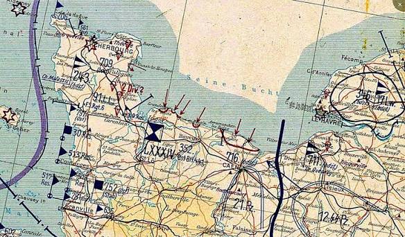
On June 6, 1944, as Allied troops stormed the beaches of Normandy, they carried a secret weapon that had nothing to do with new tanks or code-breaking machines. It was a simple road map, designed for French motorists, published by the tire company Michelin. This map, No. 51 in Michelin’s series, covering the region from Caen to Le Mans, would prove to be one of the most effective intelligence assets of the entire campaign.
The Germans had fortified the Atlantic Wall with concrete bunkers, millions of mines, and formidable artillery. But they had overlooked the humble road map. While German officers navigated with outdated military surveys, Allied commanders unfolded their Michelin maps and saw a detailed web of minor roads, farm tracks, and bridges that the German maps simply didn’t show. In the chaos of the Normandy bocage a maze of sunken lanes and earthen hedgerows this difference was decisive.
A Map Made for Tourists, Not Soldiers
Michelin began producing detailed road maps of France in 1900, not for military strategists but for the growing number of motorists who wanted to explore the countryside in their new automobiles. The company’s tire salesmen and local correspondents fed a constant stream of updates back to the mapmakers, ensuring that roads, bridges, and even isolated farms were accurately depicted. By the 1930s, these maps had become the gold standard for civilian travel in France.
When the Second World War broke out, the British War Office recognized the potential military value of these maps. They quietly began stockpiling Michelin maps, and when France fell in 1940, they made sure to secure as many copies as possible. But the real champion of the Michelin map was Major David “Dai” Rees, a Welsh cartographer with the British Army’s Geographical Section, General Staff (GSGS).
The Cartographer Who Saw the Obvious
Major Rees was not a flamboyant intelligence officer. He was a meticulous mapmaker who understood that the official military maps of Normandy were woefully inadequate. Many were based on surveys from the 19th century, and they lacked the granular detail of minor roads and sunken lanes that would be crucial for troop movements in the bocage. Rees knew that the Michelin maps, with their up-to-date road networks, gradients, and even the locations of isolated farmhouses, were infinitely better.
He faced bureaucratic resistance. Some officers dismissed the idea of using a commercial touring map for military operations. But Rees persisted, and his foresight paid off. The War Office reproduced the Michelin maps in huge numbers, classifying them as “GSGS 4249.” Hundreds of thousands of copies were printed on lightweight, color-coded paper that could be folded and stuffed into a soldier’s pocket.
The Bocage: A Navigator’s Nightmare
The terrain of Normandy was unlike anything the Allied troops had encountered. The bocage was a patchwork of small fields enclosed by thick, earthen hedgerows, often topped with trees and shrubs. Sunken lanes, worn down by centuries of use, crisscrossed the landscape. Tanks and infantry could easily get lost, and the hedgerows provided the Germans with excellent defensive positions. For the Allies, every advance required precise navigation.
German forces, by contrast, were often operating with maps that lacked the same level of detail. They had not anticipated that the Allies would rely on a civilian commercial map, and they certainly did not expect the Allies to have such intimate knowledge of the minor road network. This gave the Allies a significant navigational advantage, especially in the months of brutal fighting that followed the initial landings.
The Secret That Wasn’t
The maps were not classified documents. The secrecy lay in the fact that the Allies were using them at all, and in the scale of the reproduction effort. The Germans could not conceive that a tire company’s product for motorists would become a critical military tool. It was a cartographic sleight of hand that took the enemy by surprise.
After the war, Michelin’s role was officially acknowledged. The company was praised for its foresight in maintaining detailed, up-to-date maps of France. The maps, originally created to sell tires, had helped to liberate the country.
The Michelin map of Normandy is a reminder that sometimes the most effective tools are not the most sophisticated. A civilian road map, designed for Sunday drives, gave the Allies a crucial edge in one of the most complex military operations in history. It was a triumph of commercial cartography applied to the grim business of war, and it saved countless lives.
Summary
- The Michelin road map No. 51 (covering Caen to Le Mans) was used extensively by Allied forces during D-Day and the Battle of Normandy.
- The map provided detailed data on minor roads, bridges, and terrain features that official military maps lacked.
- Major David “Dai” Rees, a British cartographer, championed the use of the Michelin maps, overcoming bureaucratic resistance.
- The maps were mass-produced by the British War Office as “GSGS 4249” and distributed to hundreds of thousands of Allied troops.
- The Germans were unaware that the Allies relied on a civilian commercial map, giving the Allies a significant navigational advantage in the bocage country.
FAQ
Q: Were the Michelin maps classified as ‘secret’ during the war?
A: No, the maps themselves were not classified. The secrecy was in the fact that the Allies were using them at all, and in the scale of the reproduction effort.
Q: Why were the official military maps of Normandy so poor?
A: Many were based on outdated surveys, some dating back to the 19th century, and they lacked detail on minor roads and sunken lanes. Additionally, the French national mapping agency had been compromised by the Vichy regime, and some official maps were deliberately inaccurate.
Q: How did the Allies get their hands on the Michelin maps?
A: The British War Office stockpiled Michelin maps before the war, and additional copies were smuggled out of occupied France by resistance networks.
Q: What made the Michelin maps better than military maps?
A: They were updated frequently and included details like road widths, gradients, and the locations of isolated farms, making them far more accurate for navigation in the bocage.
Q: Did the Germans ever figure out that the Allies were using Michelin maps?
A: There is no evidence they did. The Germans did not anticipate that the Allies would rely on a civilian commercial map, and the Allies’ detailed knowledge of minor roads took them by surprise.