Tag: environment

  • Why Indonesia’s Peat Fires Burn for Months and How They Darken Skies

    Why Indonesia’s Peat Fires Burn for Months and How They Darken Skies

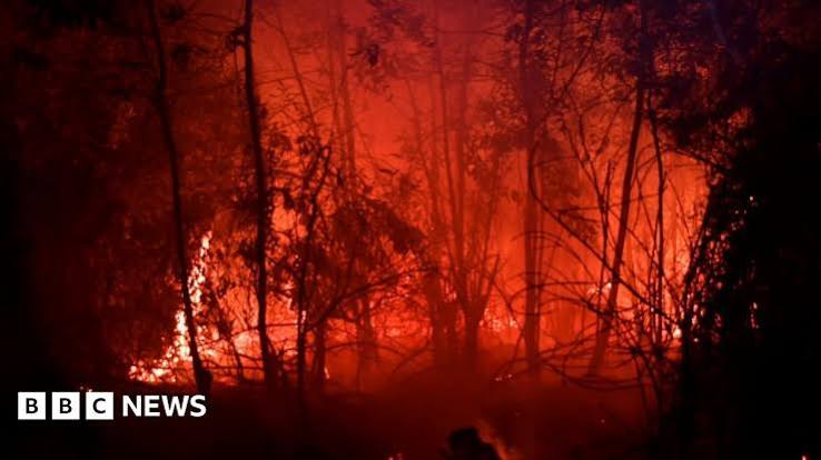
    When images of orange skies and smoke-blanketed cities emerge from Indonesia, they often signal the return of a recurring crisis: peatland fires. In recent months, satellite data from NASA FIRMS has detected thousands of fire hotspots on the islands of Sumatra and Kalimantan, with provinces like Riau, South Sumatra, Central Kalimantan, and West Kalimantan particularly affected. The fires are not your typical forest blazes they burn both above and below ground, making them notoriously difficult to extinguish and capable of smoldering for weeks or even months.

    This isn’t just an Indonesian problem. The resulting haze has pushed air quality to hazardous levels in cities like Palangkaraya, where PM2.5 concentrations have exceeded an AQI of 300, forcing schools to close and disrupting flights. The smoke also carries health risks across Southeast Asia, affecting millions in neighboring countries. Understanding why these fires happen, why they persist, and what can be done is essential for anyone concerned about climate change, public health, or the future of tropical ecosystems.

    The Hidden Fuel Beneath the Forest

    To grasp why peat fires are so severe, you need to know what peat is. Imagine a sponge made of partially decomposed leaves, wood, and other plant material, soaked in water. That’s peat. It forms over thousands of years in waterlogged areas where dead vegetation doesn’t fully rot because there’s little oxygen. Indonesia holds about 36% of the world’s tropical peatlands, which store an estimated 35 to 60 billion metric tons of carbon—that’s a massive amount of carbon locked away.

    When peatlands are drained for agriculture, usually through networks of canals, the water is removed. The once-spongy peat dries out and becomes extremely flammable. It’s like turning a wet sponge into tinder. And once ignited, the fire can creep underground, burning through the peat layer itself. These ground fires are notoriously difficult to put out because water and fire retardants often can’t reach the deep layers. They can smolder for weeks, releasing enormous amounts of smoke and carbon dioxide.

    Why Do These Fires Start?

    The immediate cause is often human activity. In Indonesia, fire is frequently used as a cheap and quick way to clear land, especially for palm oil and pulpwood plantations. Despite many large companies adopting ‘zero-burning’ policies, smallholders and illegal land clearers still rely on burning because it’s the most cost-effective method for them. Accidental ignitions from discarded cigarettes or campfires also play a role. During the dry season, particularly when an El Niño event reduces rainfall, the dried peat becomes even more combustible. This combination—dried peat, human ignition, and drought—creates the perfect storm.

    Historical patterns show that severe fire years often coincide with strong El Niño events. The 1997-98 fires were catastrophic, and the 2015 fire season was one of the worst on record, at one point emitting more CO2 daily than the entire U.S. economy. The 2015 fires were linked to over 100,000 premature deaths from smoke inhalation across Southeast Asia, according to estimates from Harvard and Columbia researchers. More recently, 2019 also saw significant fires. The current event, while still unfolding, appears to be following a similar trajectory.

    Smoke That Chokes: Health and Air Quality

    The most visible impact of peat fires is the thick, acrid haze that darkens skies and reduces visibility. This smoke is not just unpleasant—it’s a serious health hazard. It contains fine particulate matter, known as PM2.5, which can penetrate deep into the lungs and enter the bloodstream. When PM2.5 levels reach hazardous levels, as they have in several Indonesian cities, it triggers a range of health problems, from respiratory infections to heart disease and strokes. Children, the elderly, and those with pre-existing conditions are especially vulnerable.

    During the 2015 fires, schools closed, and airports shut down due to poor visibility, disrupting travel and daily life. The economic costs are staggering: healthcare burdens, lost productivity, and damage to tourism and agriculture. In 2019, the Indonesian government estimated economic losses in the billions of dollars. The haze also has transboundary effects, regularly straining relations with Malaysia and Singapore, which have repeatedly called for action to stop the annual smoke.

    Climate Consequences: A Vicious Cycle

    Peat fires are a major source of greenhouse gas emissions. When peat burns, it releases not only carbon dioxide but also methane, a potent greenhouse gas. The 2015 fires alone released an estimated 1.75 billion tons of CO2 equivalent, according to the World Resources Institute. That’s more than the annual emissions of Germany or Japan. These emissions accelerate climate change, which in turn can worsen droughts, making peat fires more likely. It’s a vicious cycle: fires contribute to climate change, and climate change creates conditions that make fires worse.

    Beyond carbon, peat fires destroy critical habitat for endangered species like orangutans and Sumatran tigers. The fires also degrade the peatland ecosystem, leaving it more vulnerable to future fires and flooding. The restoration process is slow—it can take decades for peat to re-accumulate and for the ecosystem to recover.

    What’s Being Done About It?

    The Indonesian government has taken steps to address the problem. A moratorium on new peatland development was established, and in 2016, the Peatland Restoration Agency (BRG) was set up to coordinate restoration efforts. These initiatives include blocking canals to rewet peatlands and promoting alternative farming methods that don’t rely on burning. However, enforcement is challenging. The economic pressure to expand palm oil and pulpwood plantations is strong, and many smallholder farmers have no affordable alternative to slash-and-burn.

    International pressure, such as the European Union’s deforestation regulation, aims to ensure that products sold in the EU are not linked to deforestation. This could push companies to be more responsible about their supply chains. But the problem is deeply rooted in local livelihoods and governance. As the journalist and environmentalist Satrio Nuswantoro puts it, ‘You can’t just ban fire; you have to offer an alternative that makes sense economically for farmers.’

    Looking Ahead: The Need for Sustainable Solutions

    Addressing peatland fires requires a multi-pronged approach. On the ground, efforts to rewet drained peatlands are crucial. Restoring water levels prevents the peat from drying out and becoming flammable. For communities, providing accessible alternatives to fire—such as mechanical land clearing or agroforestry systems—can reduce intentional burning. Better enforcement and monitoring using satellite data can help catch fires early, though this is only effective if there’s the capacity to respond quickly.

    Long-term, climate change mitigation is key. Reducing global emissions will lessen the severity of El Niño events and droughts, indirectly reducing fire risk. But for now, as long as peatlands remain drained and dry, the threat of fires will persist. Each fire season, we’re reminded that the health of our planet is tied to the health of these ancient, carbon-rich landscapes. Protecting them isn’t just Indonesia’s responsibility; it’s a global imperative.

    Peatland fires in Indonesia are a complex disaster with roots in land use, poverty, and climate change. They burn for months because they smolder underground, releasing toxic smoke and massive amounts of carbon. While Indonesia has made efforts to restore degraded peatlands, the challenge is immense. The fires that darken skies in Sumatra and Kalimantan are also darkening the future of our climate. Solving this will require not just policy changes but also support for communities to adopt sustainable livelihoods. Otherwise, we’ll continue to see the same orange skies year after year.

    Summary

    • Indonesia’s peatland fires burn both above and below ground, making them extremely hard to extinguish.
    • Drainage of peat for agriculture turns it into highly flammable fuel, and fires are often started by humans.
    • Severe fire years are linked to El Niño-induced droughts, as seen in 2015 and 2019.
    • Smoke from fires causes hazardous air quality, leading to health crises and economic losses.
    • Restoration efforts and sustainable land management are key to preventing future fires.

    FAQ

    Q: Why do peat fires keep happening in Indonesia?nA: The underlying cause is drained peatlands, which dry out and become highly flammable. When land is cleared for agriculture, often using fire, the dried peat can ignite and burn underground for long periods. Droughts associated with El Niño make the peat even drier and more susceptible to fires.nnQ: What are the main health risks from the haze?nA: The haze contains fine particles (PM2.5) that can penetrate deep into the lungs, causing respiratory issues, heart disease, and other illnesses. Vulnerable groups like children and the elderly are particularly at risk. Long-term exposure can lead to chronic health problems.nnQ: How do peat fires affect climate change?nA: Peat fires release huge amounts of carbon dioxide and methane, which are potent greenhouse gases. For example, the 2015 fires emitted about 1.75 billion tons of CO2 equivalent, more than the annual emissions of many countries. This accelerates global warming, which in turn can make fires more likely.nnQ: What can be done to stop the fires?nA: Restoring water levels in drained peatlands is key, as wet peat won’t burn. Providing alternative livelihoods for farmers so they don’t need to clear land with fire, and enforcing regulations against illegal burning are also important. International pressure and support for sustainable palm oil production can help.nnQ: Is the current fire season worse than previous ones?nA: The severity varies each year. It’s important to check up-to-date data from sources like Indonesia’s Ministry of Environment and Forestry or NASA FIRMS. Historically, the 2015 and 2019 fires were particularly severe, but the current situation should be assessed with current data.
  • Mapping Addis Ababa’s Air: How NASA’s MAIA Mission Uses Ground Sensors to See What We Breathe

    Mapping Addis Ababa’s Air: How NASA’s MAIA Mission Uses Ground Sensors to See What We Breathe

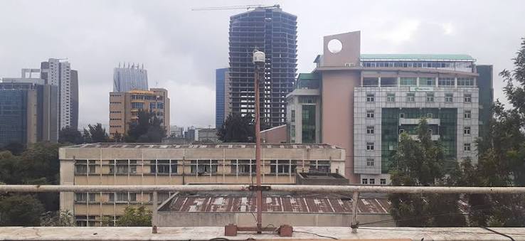
    Addis Ababa, one of Africa’s fastest-growing cities, is also one of its most polluted. But until recently, no one knew exactly how polluted or what was in the air. NASA’s MAIA mission is changing that with a network of ten ground sensors and a satellite instrument that can see pollution from space.

    This isn’t just about collecting data. It’s about understanding what people breathe at street level and connecting it to what satellites observe from orbit. The project is filling a critical gap in a continent where air quality monitoring is sparse, and it’s doing so with a technique that can tell dust from smoke from traffic exhaust.

    The Invisible Problem

    When you stand on a busy street in Addis Ababa, you might see haze or smell exhaust, but you can’t see the tiny particles that matter most for your health. These are called PM2.5—particulate matter with a diameter of 2.5 micrometers or less. For scale, that’s about 30 times smaller than a human hair. Because they’re so small, they can slip past your body’s defenses and lodge deep in your lungs or even enter your bloodstream.

    The World Health Organization estimates that air pollution causes millions of premature deaths each year, and Africa is no exception. Yet many African cities have no formal air quality monitoring at all. Addis Ababa, with its rapid urbanization, increasing traffic, and seasonal dust and smoke, was a prime candidate for study.

    NASA’s MAIA Mission: A New Way to See Pollution

    MAIA stands for Multi-Angle Imager for Aerosols. It’s a NASA Earth-ventures instrument—a mission that’s competitively selected and cost-capped, meaning it’s designed to be efficient and focused. Instead of flying on a dedicated NASA spacecraft, MAIA will be hosted on a commercial satellite, a relatively new approach that reduces cost.

    What makes MAIA special is its use of multi-angle polarimetry. Imagine looking at a shiny car hood from different angles—the glare changes. Similarly, MAIA views the same patch of Earth from multiple angles and measures the polarization of reflected light. This allows it to distinguish between different types of aerosols: dust, smoke, sulfates, nitrates, and more. This is a huge improvement over older sensors that could only see a single gray blob of pollution.

    But satellites see from space, and what we really care about is what’s at ground level. That’s where the ten ground sensors come in.

    Ground Truth in Addis Ababa

    For about three years, ten sensors scattered across Addis Ababa have been measuring PM2.5 in real time. These sensors are placed at strategic locations—near schools, hospitals, traffic intersections, and residential areas—to capture a representative sample of the city’s air.

    The role of these sensors is to serve as “ground truth.” When the MAIA satellite passes overhead, it measures the light reflected from the atmosphere. But that measurement is influenced by clouds, surface brightness, and other factors. To know exactly what’s in the air, you need a comparison point on the ground. The sensors provide that. They tell researchers exactly how much PM2.5 is present at street level at that moment, which can be compared to what the satellite sees.

    This calibration and validation process is essential. Without it, satellite data can be wildly inaccurate. With it, you can build a reliable picture of air pollution across the entire city, not just where the sensors are.

    Why Addis Ababa?

    Addis Ababa was chosen as one of MAIA’s primary target cities because it faces a perfect storm of pollution sources. During the dry season, dust from the Sahara and local arid lands blows in. Biomass burning—from cooking fires and agricultural clearing—adds smoke. And the city’s booming economy means more cars and factories pumping out exhaust and industrial emissions.

    But there’s another reason: the data gap. Like many African cities, Addis Ababa had very few air quality monitors. This project demonstrates a model for filling that gap, not just for research, but for public health and policy.

    What the Data Will Tell Us

    The combination of satellite and ground data will produce one of the most detailed, high-resolution maps of air pollution ever created for an African city. This map can be used in several ways:

    • Identify hotspots: Where are the worst pollution levels? Near busy roads? Industrial zones? Low-income neighborhoods?
    • Understand sources: MAIA can tell whether the pollution is dust, smoke, or traffic-related. This is crucial for designing targeted mitigation strategies.
    • Inform health research: MAIA’s ultimate goal is to link aerosol exposure to health outcomes like respiratory and cardiovascular disease. The Addis Ababa data will feed into epidemiological studies that examine these links in an African context.

    The Human Element

    Projects like this don’t succeed on technology alone. They require local partnerships—universities, government agencies, and NGOs—to maintain the sensors, interpret the data, and turn it into action. The project also provides training opportunities, leaving behind lasting monitoring infrastructure and local expertise.

    Public access to the data can empower citizens to advocate for cleaner air. When you can see that the school your child attends is in a pollution hotspot, you have a reason to demand change.

    The MAIA mission in Addis Ababa is more than a scientific exercise. It’s a proof of concept for how modern remote sensing can address real-world problems in places that need it most. By combining cutting-edge satellite technology with ground-based sensors, NASA and its partners are not just mapping pollution—they’re giving a city the tools to breathe easier.

    Summary

    • NASA’s MAIA mission uses a satellite instrument and ten ground sensors to study air pollution in Addis Ababa, Ethiopia.
    • The sensors measure PM2.5, fine particles that are harmful to human health.
    • MAIA’s multi-angle polarimetry can distinguish different types of aerosols, such as dust, smoke, and traffic pollution.
    • The ground sensors serve as “ground truth” to calibrate and validate satellite measurements.
    • The project fills a critical data gap in Africa and will produce high-resolution pollution maps to inform public health and policy.

    FAQ

    Q: What is PM2.5?
    A: PM2.5 refers to particulate matter with a diameter of 2.5 micrometers or less. These tiny particles can penetrate deep into the lungs and bloodstream, causing health problems.

    Q: How does the MAIA satellite measure pollution?
    A: MAIA uses multi-angle polarimetry, viewing the same scene from multiple angles and measuring the polarization of reflected light to distinguish different types of aerosols.

    Q: Why are ground sensors needed if there’s a satellite?
    A: Ground sensors provide “ground truth”—actual measurements of air pollution at street level. They are used to calibrate and validate the satellite data, ensuring accuracy.

    Q: What makes Addis Ababa a target city for MAIA?
    A: Addis Ababa has severe air pollution from dust, biomass burning, and vehicle emissions, and it lacked sufficient ground-based monitoring, making it a priority for detailed study.

    Q: How will this data benefit the people of Addis Ababa?
    A: The data will create detailed pollution maps to identify hotspots, inform public health advisories, and guide city planning to reduce exposure and improve air quality.

  • Why Western Europe’s 2026 Wildfires Were a Climate Wake-Up Call

    Why Western Europe’s 2026 Wildfires Were a Climate Wake-Up Call

    In the summer of 2022, Western Europe faced an unprecedented wildfire crisis. France and Spain saw record-breaking burns, with tens of thousands of people evacuated from their homes. For many, it felt like a scene from a disaster movie, but it was a stark reality driven by a changing climate.

    This article explores the science behind these fires, the role of climate change, and what they mean for the future. We’ll break down the complex factors—from heatwaves and drought to forest management—that turned a dry summer into a fiery inferno, and why this is a wake-up call for the entire continent.

    The 2022 Fire Season in Numbers

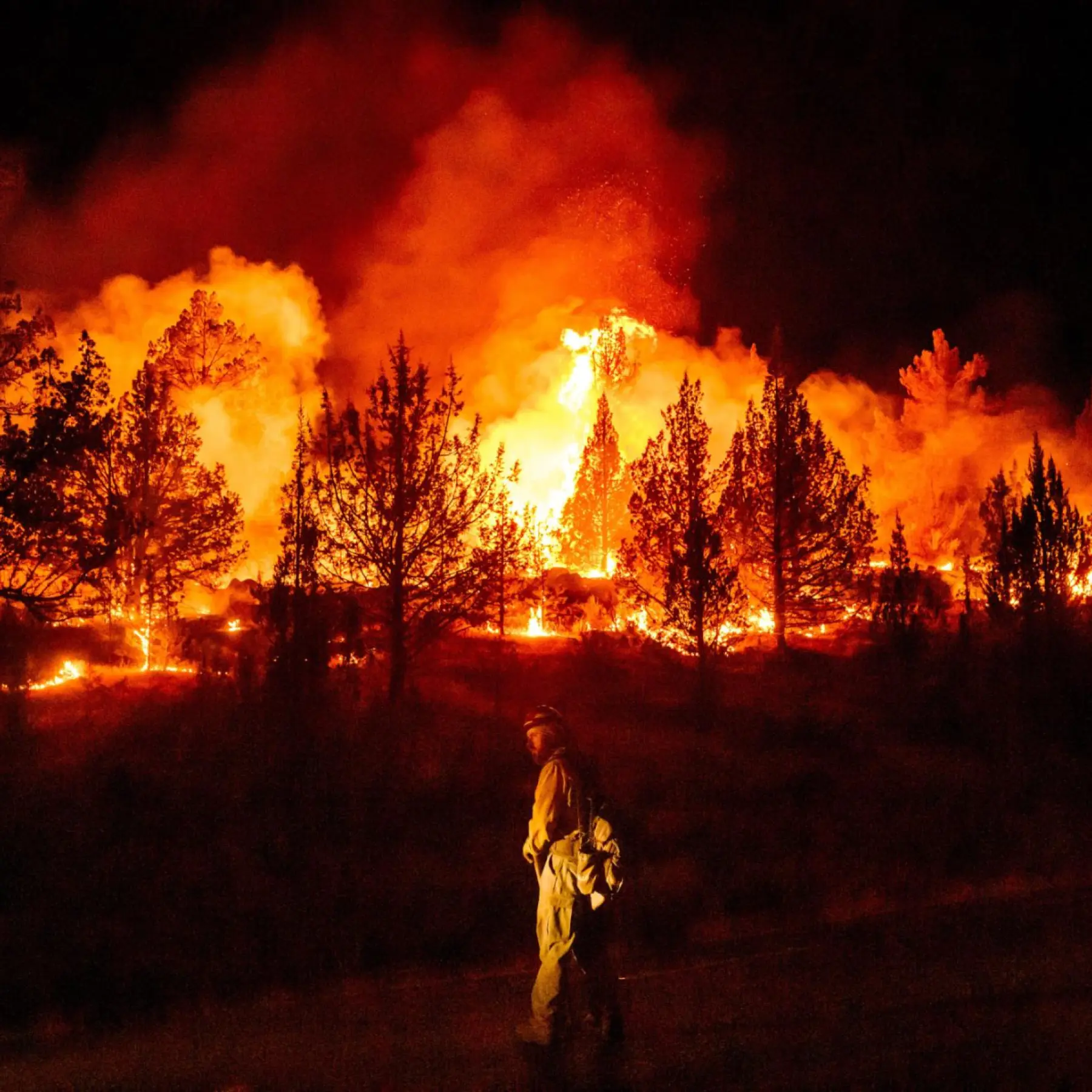
    The summer of 2022 was not just hot; it was historically destructive. In France, over 60,000 hectares (about 148,000 acres) went up in flames—more than six times the 15-year average. The Gironde region in the southwest saw two massive fires in July and August that together burned around 28,000 hectares and forced the evacuation of roughly 40,000 people, including many tourists. Spain fared even worse, with over 280,000 hectares burned by mid-August—the worst year on record, surpassing 2012. Portugal also suffered, with about 100,000 hectares lost, including a massive blaze in Serra da Estrela.

    These numbers are staggering, but they only tell part of the story. The fires were fueled by extreme weather: Europe experienced four distinct heatwaves in 2022. In July, temperatures soared above 40°C (104°F) in parts of France, Spain, and Portugal. Even the UK, not typically known for such extremes, recorded its first-ever 40°C reading on July 19. Compounding the heat was a severe drought—the worst in at least 500 years, according to the EU’s Joint Research Centre—with soil moisture at record lows. This combination turned forests into tinderboxes.

    The Science of Fire Weather

    To understand why these fires were so intense, we need to look at a tool called the Fire Weather Index (FWI). It’s a bit like a weather forecast for fire risk, combining temperature, humidity, wind speed, and recent rainfall. When the FWI is high, conditions are ripe for fires to start and spread rapidly. In the summer of 2022, Western Europe experienced extreme FWI values—conditions that were previously rare in the region. This is a clear sign that the fire season is no longer confined to the Mediterranean; it’s moving north.

    But weather is only part of the equation. The landscape itself plays a huge role. For decades, fire suppression policies have allowed undergrowth and dead vegetation to accumulate, creating dense fuel loads. Think of it like a forest that has never been cleaned: leaves, branches, and dry grass pile up, providing ample material for a fire to consume. Additionally, many forests in Western Europe are monocultures—plantations of highly flammable species like maritime pine and eucalyptus. These trees are like gasoline-soaked matches, ready to ignite.

    Climate Change: The Amplifier

    So, was climate change directly responsible for the 2022 fires? Scientists from the World Weather Attribution group conducted a study and found that the July heatwave in Western Europe was made about 2°C hotter and roughly 10 times more likely due to human-caused climate change. The drought was similarly amplified. In essence, climate change didn’t start the fires, but it made the conditions far more extreme, turning a bad fire season into a catastrophic one.

    This is not just about one summer. The 2022 fires are part of a broader trend. Historically, Western Europe experienced wildfires mainly in the Mediterranean basin—southern Spain, Portugal, Greece, and southern France. But in 2022, the fire line pushed northward into regions like Brittany and Normandy in France, and even the UK saw a record number of wildfires in July. This expansion is a direct consequence of a warming climate, which is making fire weather more common across the continent.

    The Human and Economic Toll

    While the 2022 fires did not cause the massive loss of life seen in previous disasters (like the 2017 Portugal fires that killed 66 people), they still had a profound impact. In Spain, a firefighter died battling the blazes. Thousands of people were evacuated, and homes, businesses, and natural habitats were destroyed. The economic cost is still being calculated, but it runs into billions of euros.

    There’s also a hidden cost: the carbon emissions. The 2022 fires in Europe released an estimated 6.4 megatonnes of carbon, according to the Copernicus Atmosphere Monitoring Service. This creates a dangerous feedback loop: fires release CO₂, which contributes to global warming, which in turn makes fires more likely. It’s a vicious cycle that we’re only beginning to understand.

    Fighting the Flames: Challenges and Responses

    Firefighting in Western Europe is a massive operation. In France, at the peak of the crisis, about 10,000 firefighters were deployed, with reinforcements from Germany, Poland, Romania, and Greece through the EU Civil Protection Mechanism. Spain activated its Military Emergency Unit for multiple fires. Both countries relied heavily on aerial firefighting fleets—water bombers and helicopters—but they faced challenges. Aging equipment and limited night-flying capability hampered efforts, especially when fires raged out of control.

    But fighting fires is only half the battle. Prevention is key. For years, the EU’s Common Agricultural Policy actually incentivized planting fast-growing, fire-prone species like eucalyptus and pine, contributing to the problem. Rural depopulation has also reduced traditional land management practices like grazing and controlled burns, which used to keep fuel loads in check. As a result, forests have become denser and more vulnerable.

    Looking Ahead: Adaptation and Mitigation

    So, what can be done? First, we must adapt to a new reality where wildfires are more frequent and intense. This means investing in better firefighting equipment, including night-flying capabilities, and improving early warning systems. It also means managing forests more actively—thinning dense stands, reintroducing controlled burns, and diversifying tree species to make landscapes more resilient.

    On a broader scale, we must tackle the root cause: climate change. The 2022 fires are a stark reminder that global warming is not a distant threat; it’s happening now, and it’s affecting our lives. Reducing greenhouse gas emissions is essential to prevent the worst-case scenarios. But even with aggressive mitigation, some level of warming is already locked in, so adaptation is crucial.

    In conclusion, the 2022 wildfires in Western Europe were a wake-up call. They showed that no region is immune to the impacts of climate change. By understanding the science behind these fires and taking proactive steps, we can better prepare for the challenges ahead.

    The 2022 fire season in Western Europe was a stark reminder that climate change is not a distant threat—it’s here, and it’s reshaping our world. The fires were a product of extreme heat, drought, and decades of forest management practices that left landscapes primed to burn. While the immediate crisis may have passed, the underlying conditions remain. It’s time to rethink how we manage our forests, how we fight fires, and how we address the root cause: our carbon emissions. The future will bring more fire, but with foresight and action, we can reduce the damage and protect our communities.

    Summary

    • In 2022, France and Spain experienced their worst wildfire seasons on record, with over 60,000 and 280,000 hectares burned, respectively.
    • The fires were fueled by extreme heatwaves and a severe drought, made more likely and intense by climate change.
    • The Fire Weather Index, which measures fire risk, reached unprecedented levels across Western Europe, pushing fires into regions not historically prone to them.
    • Decades of fire suppression and monoculture plantations have created dense fuel loads, making forests more vulnerable.
    • Adaptation measures, such as better forest management and improved firefighting capabilities, are essential, but reducing emissions is critical to prevent worse outcomes.

    FAQ

    Q: What caused the 2022 wildfires in Western Europe?
    A: The fires were primarily caused by a combination of extreme heat, drought, and strong winds, which created ideal fire weather conditions. Human activities, such as accidental ignitions, also played a role, but the severity was amplified by climate change.

    Q: How did climate change affect the fires?
    A: Climate change made the heatwave and drought more likely and more intense. Scientists found that the July 2022 heatwave was about 2°C hotter and 10 times more likely due to human-caused climate change, which directly increased fire risk.

    Q: Why are forests in Western Europe so flammable?
    A: Many forests are monocultures of highly flammable species like pine and eucalyptus, and decades of fire suppression have allowed undergrowth to accumulate, creating dense fuel loads. Rural depopulation has also reduced traditional land management practices that used to keep fuel in check.

    Q: Can we prevent such fires in the future?
    A: While we can’t prevent all fires, we can reduce their severity through better forest management, such as thinning, controlled burns, and diversifying tree species. Improved firefighting capabilities and early warning systems are also crucial. However, addressing climate change is essential to reduce the underlying risk.

    Q: Were there any fatalities in the 2022 fires?
    A: Fortunately, there was no major loss of life in France or Spain, but a firefighter died in Spain. The relatively low death toll was due to effective evacuations, but the fires still caused significant economic and environmental damage.