Tag: Colorado River

  • The Salton Sea: How a Broken Canal Created California’s Accidental Oasis and Its Slow-Motion Crisis

    The Salton Sea: How a Broken Canal Created California’s Accidental Oasis and Its Slow-Motion Crisis

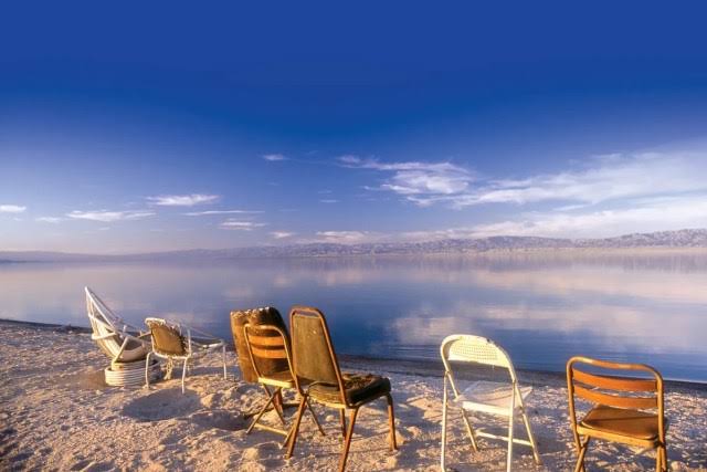
    In 1905, the Colorado River burst through a poorly built irrigation canal and poured into a dry desert basin for 18 months. The result was California’s largest lake the Salton Sea a shimmering accident that became a playground for celebrities, a haven for migratory birds, and, eventually, a toxic crisis.

    Today, the sea is shrinking, its water growing saltier than the ocean, and its exposed lakebed sends dust laced with arsenic and pesticides into nearby communities. This is the story of how a human error created an oasis, and how that oasis is now unraveling with lessons for water management, ecology, and the unintended consequences of engineering.

    A River Gone Wild

    The Salton Sea sits about 150 miles southeast of Los Angeles, in a basin that has flooded and dried for millennia. Ancient Lake Cahuilla once covered the area when the Colorado River shifted course. But the modern sea wasn’t born of geology alone—it was born of a mistake.

    In 1900, the California Development Company dug canals from the Colorado River to irrigate the Imperial Valley, turning desert into farmland. The headgate controlling the flow was made of wood, and in 1905, heavy rains and snowmelt swelled the river. The gate failed, and the entire Colorado River redirected into the canal system, pouring into the Salton Sink.

    For 18 months, the river ran unchecked. It flooded farmland, buried a railroad line, and created a lake where none had been. Southern Pacific Railroad finally stopped the flow in 1907 by dumping rock and gravel from trains into the breach. But the damage—or the gift—was done. The Salton Sea was here to stay.

    An Accidental Playground

    For decades, the accidental sea was a boon. Freshwater from irrigation runoff kept salinity tolerable, and the lake became a recreational paradise. In the 1950s, resorts and yacht clubs lined its shores. Frank Sinatra, the Beach Boys, and Jerry Lewis visited. Water skiers carved across its surface, and fishermen pulled in tilapia and corvina.

    The sea also became a critical stopover on the Pacific Flyway. Over 400 bird species have been documented there, with millions of migratory birds passing through annually. Eared grebes, American white pelicans, and countless others relied on its fish and invertebrates.

    The Slow Poisoning

    The Salton Sea has no natural outlet. Water leaves only by evaporation, which means salts and pollutants stay behind, concentrating over time. Agricultural runoff from the Imperial, Coachella, and Mexicali valleys carried fertilizers, pesticides, and selenium into the lake. As salinity climbed, fish began to die.

    By the 1980s, the sport fishery had collapsed. In the 1990s, major fish kills and botulism outbreaks became routine. Today, only tilapia—an invasive species—remain, and even they die off in summer heat. The sea is now about 50% saltier than the Pacific Ocean, with salinity around 44,000 to 50,000 parts per million.

    The Water Deal That Starved the Sea

    The most recent blow came in 2003, when the Imperial Irrigation District signed the Quantification Settlement Agreement (QSA), transferring water to San Diego. The deal was meant to address urban water needs, but it reduced the agricultural runoff that fed the sea. Inflow dropped, and the sea began to shrink faster.

    Now, the shoreline retreats by about 6 inches to a foot each year in elevation loss. More than 50,000 acres of lakebed—the playa—have been exposed, and that dry ground is a source of toxic dust. Windblown particles contain selenium, arsenic, and pesticides. Communities in the Imperial Valley, already among the poorest in California, face some of the worst air quality in the nation, with disproportionately high asthma rates.

    An Ecological and Public Health Crisis

    The Salton Sea’s decline isn’t just an ecological loss; it’s a public health emergency. As the playa expands, dust storms become more frequent, carrying contaminants into nearby towns. The sea’s ecosystem has all but collapsed, yet it still supports millions of migratory birds that depend on it as a critical stopover.

    Restoration efforts have been proposed, but they face enormous challenges. Some argue that the sea is beyond saving and that we should focus on managing its retreat—dampening dust and creating smaller, sustainable habitats. Others push for large-scale water imports or desalination, though the costs are astronomical.

    The Salton Sea offers a stark lesson: when we alter natural systems, the consequences can ripple for decades. The sea was an accident, but its decline was inevitable once we stopped the flow. The question now is how we manage what remains—and what we learn from this accidental oasis turned cautionary tale.

    The Salton Sea is a reminder that nature doesn’t forget our mistakes. What began as a broken canal headgate became a vibrant oasis, and what followed was a slow unraveling driven by salinity, pollution, and water politics. As the sea shrinks and dust rises, the people living nearby pay the price. Whether through restoration or managed retreat, the Salton Sea demands a response—not just for the birds and fish, but for the communities breathing its toxic air.

    Summary

    • The Salton Sea was created accidentally in 1905 when a Colorado River irrigation canal breached, flooding a desert basin for 18 months.
    • It became a recreational hotspot in the 1950s and a critical habitat for over 400 bird species on the Pacific Flyway.
    • Because it has no outlet, evaporation concentrates salts and pollutants from agricultural runoff, making it saltier than the ocean and toxic to fish.
    • The 2003 Quantification Settlement Agreement reduced water inflow, accelerating the sea’s shrinkage and exposing toxic lakebed dust.
    • The exposed playa poses a public health risk, with high rates of asthma in nearby Imperial Valley communities.

    FAQ

    Q: How was the Salton Sea created?
    A: In 1905, a poorly built wooden headgate on a Colorado River irrigation canal failed during heavy floods, causing the entire river to flow into the Salton Sink for 18 months. Southern Pacific Railroad stopped the flow in 1907, but the sea remained.

    Q: Why is the Salton Sea so salty?
    A: The sea has no natural outlet. Water only escapes through evaporation, leaving behind salts and minerals from agricultural runoff, which has made it about 50% saltier than the Pacific Ocean.

    Q: Is the Salton Sea still a habitat for birds?
    A: Yes, it remains a critical stopover on the Pacific Flyway, supporting millions of migratory birds. However, the ecosystem is stressed, with only invasive tilapia surviving, and bird die-offs occur.

    Q: What are the health risks of the drying Salton Sea?
    A: As the lakebed dries, windblown dust carries selenium, arsenic, and pesticides, contributing to poor air quality and high asthma rates in nearby communities.

    Q: Can the Salton Sea be restored?
    A: Restoration is challenging and expensive. Some proposals include building smaller ponds to manage salinity, while others suggest letting it dry and focusing on dust suppression. No comprehensive solution is yet in place.
  • Half the World’s Dams Could Be Dead by 2060 Here’s Why Sediment Is the Silent Killer

    Half the World’s Dams Could Be Dead by 2060 Here’s Why Sediment Is the Silent Killer

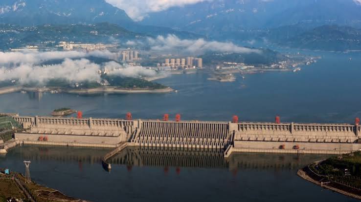
    A new study from the United Nations University projects that by 2060, half of the world’s large dams could be functionally inoperable not because of structural failure, but because they’ll be choked with sediment. The American West, particularly the Colorado River Basin, is a major hotspot, with Lake Mead and Lake Powell already losing significant capacity.

    This isn’t a distant problem. It’s happening now. One-fifth of the world’s reservoirs are already at high risk of filling with sediment, and the consequences—for water supply, hydropower, and flood control—are enormous. Yet the issue remains largely out of public view, overshadowed by more visible water crises.

    Understanding why dams silt up, how it affects you, and what can be done is essential for anyone who relies on water stored behind a dam—which is nearly everyone on the planet.

    The Hidden Threat: What Is Reservoir Sedimentation?

    When a dam is built, it doesn’t just hold back water—it also traps the sand, silt, and clay that rivers carry downstream. This sediment settles to the bottom of the reservoir, slowly reducing its storage capacity. It’s a natural process, but human activities—deforestation, agriculture, mining, and urbanization—have dramatically increased sediment loads in many rivers, often by 2 to 10 times natural rates.

    Think of it like a bathtub filling with sand while the tap is running. Eventually, the tub has less room for water. For a dam, that means less water available for drinking, irrigation, and industry. It also means less capacity to hold back floodwaters, and less pressure to spin hydropower turbines.

    The problem isn’t new. The U.S. Bureau of Reclamation began measuring reservoir sedimentation in the 1920s. But the scale of the issue is only now becoming clear, thanks to a 2024 study in the journal Innovation that analyzed over 47,000 large dams globally using satellite data and modeling.

    The Numbers Behind the Crisis

    The study’s projections are stark. Currently, about 20% of the world’s reservoirs are at high risk of filling with sediment. By 2060, that could rise to 50%—meaning half of all large dams could be functionally inoperable. “Functionally inoperable” doesn’t mean the dam will collapse; it means the reservoir will have lost so much capacity that it can no longer serve its primary purposes—storing water, generating power, or controlling floods.

    Globally, reservoirs lose about 0.5–1% of their storage capacity each year to sedimentation. That might sound small, but over a decade, it adds up to 1–2% of global water storage capacity. To put it in financial terms, the UNU estimates it would cost $10–20 trillion to replace the lost storage capacity worldwide over the next 50 years.

    The American West: A Cautionary Tale

    The Colorado River Basin is a prime example. Lake Mead and Lake Powell—the two largest reservoirs in the U.S.—have already lost significant capacity to sediment. Lake Mead has lost about 4% of its capacity since 1935, roughly 3.5 million acre-feet. Lake Powell has lost about 6% since 1963. That’s water that could have been used for cities, farms, and ecosystems.

    But the problem extends beyond the Colorado. The Rio Grande, the Missouri River, and numerous smaller dams in California and the Pacific Northwest are also affected. And globally, other hotspots include the Aswan High Dam on the Nile, the Tarbela Dam in Pakistan’s Indus Basin, and China’s Yellow River—which historically carries the world’s highest sediment load.

    Why It’s a ‘Ticking Time Bomb’

    The UNU researchers describe the problem as a “ticking time bomb” because it’s not gradual. Many reservoirs will cross a threshold—around 80% sediment fill—where they become economically unviable to manage. Once that happens, the dam is effectively dead. The window for action is narrowing.

    Several factors are making things worse. Climate change is increasing the frequency and intensity of wildfires, which in turn increases erosion and sediment runoff. Changing precipitation patterns mean more intense storms, which carry more sediment. And prolonged droughts reduce the flushing flows that would naturally clear some sediment.

    What Can Be Done? Engineering Solutions and Their Limits

    There are ways to manage sediment, but each comes with trade-offs. Flushing involves releasing large volumes of water to scour sediment out of the reservoir. It’s effective but requires water that many regions can’t spare, especially during droughts. Sluicing passes sediment through the dam during flood events, but it requires careful timing and can disrupt downstream ecosystems. Dredging is expensive—$5 to $20 per cubic meter—and often impractical on a large scale.

    Newer approaches include designing dams with sediment-routing capabilities, creating off-channel storage, and using adaptive management strategies that adjust operations based on sediment levels. But these are not yet widespread.

    The Growing Case for Dam Removal

    In some cases, dam removal is the most practical solution. The U.S. has removed over 2,000 dams in the past 30 years, including the largest removal in history on the Klamath River in 2023–2024. Removing a dam can restore natural sediment flow, revive river ecosystems, and eliminate the costs of maintaining a dying structure. But removal isn’t always feasible—some dams provide essential water storage or flood protection that can’t be easily replaced.

    The Economic and Infrastructure Challenge

    Aging dams are a global infrastructure challenge. The American Society of Civil Engineers gives U.S. dams a poor grade, and many are reaching the end of their design life. The cost of replacing lost storage is far higher than the cost of proactive sediment management. Yet, funding for sediment removal and dam modernization remains limited.

    Ignoring the problem won’t make it go away. As reservoirs fill with sediment, water supplies will dwindle, hydropower output will drop, and flood risks will rise. The choices made now—whether to invest in sediment management, redesign dams, or remove them—will shape water security for generations.

    The sediment crisis is a slow-moving disaster that demands immediate attention. Half of the world’s dams could be functionally inoperable by 2060, and the American West is already feeling the effects. The solutions exist, but they require political will, funding, and a willingness to rethink how we manage our water infrastructure. The time to act is now, before more reservoirs cross the point of no return.

    Summary

    • A 2024 UNU study projects that 50% of the world’s large dams could be functionally inoperable by 2060 due to sediment accumulation.
    • Currently, 20% of reservoirs are at high risk of filling with sediment, a ‘ticking time bomb’.
    • The American West, especially Lake Mead and Lake Powell, is a major hotspot, with significant capacity already lost.
    • Sediment management techniques exist (flushing, dredging, sluicing) but are costly or conflict with water needs.
    • Dam removal is increasingly seen as a viable option, with over 2,000 dams removed in the U.S. in recent decades.

    FAQ

    Q: What does ‘functionally inoperable’ mean for a dam?
    A: It means the reservoir has lost so much storage capacity to sediment that it can no longer serve its main purposes—like storing water, generating hydropower, or controlling floods—effectively. The dam itself may still stand, but it’s essentially useless.

    Q: How does sediment get into reservoirs?
    A: Rivers naturally carry sediment (sand, silt, clay) downstream. When a dam blocks the river, that sediment settles and accumulates behind the dam. Human activities like deforestation, agriculture, and mining can increase the amount of sediment a river carries.

    Q: Can’t we just dredge the sediment out?
    A: Yes, but it’s very expensive—$5 to $20 per cubic meter—and often impractical for large reservoirs. Dredging is used in some cases, but for many reservoirs, the cost is prohibitive.

    Q: What are the main hotspots for this problem?
    A: The American West (especially the Colorado River Basin), the Nile River (Aswan High Dam), the Indus Basin (Tarbela Dam), and the Yellow River in China are all major hotspots.

    Q: Is dam removal a realistic solution?
    A: In some cases, yes. The U.S. has removed over 2,000 dams in the past 30 years, including the largest removal in history on the Klamath River. However, removal isn’t always possible, as some dams provide critical water storage or flood protection.