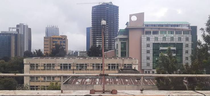
Addis Ababa, one of Africa’s fastest-growing cities, is also one of its most polluted. But until recently, no one knew exactly how polluted or what was in the air. NASA’s MAIA mission is changing that with a network of ten ground sensors and a satellite instrument that can see pollution from space.
This isn’t just about collecting data. It’s about understanding what people breathe at street level and connecting it to what satellites observe from orbit. The project is filling a critical gap in a continent where air quality monitoring is sparse, and it’s doing so with a technique that can tell dust from smoke from traffic exhaust.
The Invisible Problem
When you stand on a busy street in Addis Ababa, you might see haze or smell exhaust, but you can’t see the tiny particles that matter most for your health. These are called PM2.5—particulate matter with a diameter of 2.5 micrometers or less. For scale, that’s about 30 times smaller than a human hair. Because they’re so small, they can slip past your body’s defenses and lodge deep in your lungs or even enter your bloodstream.
The World Health Organization estimates that air pollution causes millions of premature deaths each year, and Africa is no exception. Yet many African cities have no formal air quality monitoring at all. Addis Ababa, with its rapid urbanization, increasing traffic, and seasonal dust and smoke, was a prime candidate for study.
NASA’s MAIA Mission: A New Way to See Pollution
MAIA stands for Multi-Angle Imager for Aerosols. It’s a NASA Earth-ventures instrument—a mission that’s competitively selected and cost-capped, meaning it’s designed to be efficient and focused. Instead of flying on a dedicated NASA spacecraft, MAIA will be hosted on a commercial satellite, a relatively new approach that reduces cost.
What makes MAIA special is its use of multi-angle polarimetry. Imagine looking at a shiny car hood from different angles—the glare changes. Similarly, MAIA views the same patch of Earth from multiple angles and measures the polarization of reflected light. This allows it to distinguish between different types of aerosols: dust, smoke, sulfates, nitrates, and more. This is a huge improvement over older sensors that could only see a single gray blob of pollution.
But satellites see from space, and what we really care about is what’s at ground level. That’s where the ten ground sensors come in.
Ground Truth in Addis Ababa
For about three years, ten sensors scattered across Addis Ababa have been measuring PM2.5 in real time. These sensors are placed at strategic locations—near schools, hospitals, traffic intersections, and residential areas—to capture a representative sample of the city’s air.
The role of these sensors is to serve as “ground truth.” When the MAIA satellite passes overhead, it measures the light reflected from the atmosphere. But that measurement is influenced by clouds, surface brightness, and other factors. To know exactly what’s in the air, you need a comparison point on the ground. The sensors provide that. They tell researchers exactly how much PM2.5 is present at street level at that moment, which can be compared to what the satellite sees.
This calibration and validation process is essential. Without it, satellite data can be wildly inaccurate. With it, you can build a reliable picture of air pollution across the entire city, not just where the sensors are.
Why Addis Ababa?
Addis Ababa was chosen as one of MAIA’s primary target cities because it faces a perfect storm of pollution sources. During the dry season, dust from the Sahara and local arid lands blows in. Biomass burning—from cooking fires and agricultural clearing—adds smoke. And the city’s booming economy means more cars and factories pumping out exhaust and industrial emissions.
But there’s another reason: the data gap. Like many African cities, Addis Ababa had very few air quality monitors. This project demonstrates a model for filling that gap, not just for research, but for public health and policy.
What the Data Will Tell Us
The combination of satellite and ground data will produce one of the most detailed, high-resolution maps of air pollution ever created for an African city. This map can be used in several ways:
- Identify hotspots: Where are the worst pollution levels? Near busy roads? Industrial zones? Low-income neighborhoods?
- Understand sources: MAIA can tell whether the pollution is dust, smoke, or traffic-related. This is crucial for designing targeted mitigation strategies.
- Inform health research: MAIA’s ultimate goal is to link aerosol exposure to health outcomes like respiratory and cardiovascular disease. The Addis Ababa data will feed into epidemiological studies that examine these links in an African context.
The Human Element
Projects like this don’t succeed on technology alone. They require local partnerships—universities, government agencies, and NGOs—to maintain the sensors, interpret the data, and turn it into action. The project also provides training opportunities, leaving behind lasting monitoring infrastructure and local expertise.
Public access to the data can empower citizens to advocate for cleaner air. When you can see that the school your child attends is in a pollution hotspot, you have a reason to demand change.
The MAIA mission in Addis Ababa is more than a scientific exercise. It’s a proof of concept for how modern remote sensing can address real-world problems in places that need it most. By combining cutting-edge satellite technology with ground-based sensors, NASA and its partners are not just mapping pollution—they’re giving a city the tools to breathe easier.
Summary
- NASA’s MAIA mission uses a satellite instrument and ten ground sensors to study air pollution in Addis Ababa, Ethiopia.
- The sensors measure PM2.5, fine particles that are harmful to human health.
- MAIA’s multi-angle polarimetry can distinguish different types of aerosols, such as dust, smoke, and traffic pollution.
- The ground sensors serve as “ground truth” to calibrate and validate satellite measurements.
- The project fills a critical data gap in Africa and will produce high-resolution pollution maps to inform public health and policy.
FAQ
Q: What is PM2.5?
A: PM2.5 refers to particulate matter with a diameter of 2.5 micrometers or less. These tiny particles can penetrate deep into the lungs and bloodstream, causing health problems.
Q: How does the MAIA satellite measure pollution?
A: MAIA uses multi-angle polarimetry, viewing the same scene from multiple angles and measuring the polarization of reflected light to distinguish different types of aerosols.
Q: Why are ground sensors needed if there’s a satellite?
A: Ground sensors provide “ground truth”—actual measurements of air pollution at street level. They are used to calibrate and validate the satellite data, ensuring accuracy.
Q: What makes Addis Ababa a target city for MAIA?
A: Addis Ababa has severe air pollution from dust, biomass burning, and vehicle emissions, and it lacked sufficient ground-based monitoring, making it a priority for detailed study.
Q: How will this data benefit the people of Addis Ababa?
A: The data will create detailed pollution maps to identify hotspots, inform public health advisories, and guide city planning to reduce exposure and improve air quality.